|
search place name
|
||
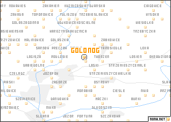
Gołonóg (Poland)Gołonóg is a town in Poland. An overview map of the region around Gołonóg is displayed below.
regional and 3d topo map of Gołonóg, Poland ::
Gołonóg airports ::
The nearest airport is KTW - Katowice Pyrzowice, located 17.6 km north west of Gołonóg.
Other airports nearby include KRK - Krakow Balice (49.7 km south east), OSR - Ostrava Mosnov (108.4 km south west), TAT - Poprad Tatry (159.5 km south east), PRV - Prerov (166.8 km south west), Nearby towns ::
Łęknice (0.0km north) //
Piekło (2.2km north west) //
Laski (2.2km south east) //
Pogoria (2.2km north east) //
Tworzeń (2.4km east) //
Bielowizna (3.9km north) //
Dąbrowa Górnicza (3.0km south west) //
Wygiełzów (4.4km north east) //
Podłosie (3.5km west) //
Kazimierz (5.6km south) //
Ujejsce (5.7km north) //
Starosiedle (4.0km north east) //
Preczów (4.0km north west) //
Grabocin (5.7km south) //
Ząbkowice (5.1km north east) //
Golaszka (5.1km north west) //
Waręzyńska Kuźnica (6.0km north west) //
Strzemieszyce Wielkie (5.1km south east) //
Ostrowy (6.0km south east) //
Bory (4.7km west) //
Pekin (7.4km south) //
Porąbka (7.4km south) //
Wojkowice Kościelne (7.5km north) //
Pierkowskie (7.5km north) //
Niemce (7.5km south) //
Zagórze (6.6km south west) //
Józefów (6.0km south west) //
Klimontów (7.8km south) //
Sosnowiec (7.3km south west) //
[all distances 'as the bird flies' and approximate] 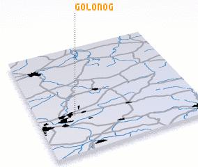 Places with similar names to Gołonóg, Poland ::
Disclaimer :: Information on this page comes without warranty of any kind |
||
|
Where is Gołonóg? Elevation and coordinates ::
Latitude (lat): 50°21'0"N Longitude (lon): 19°14'0"E
Elevation (approx.): 285m (map arrows pan, magnifying glasses zoom) |
||
|
Visiting Gołonóg? Hotel/Accommodation ::
Book a hotel in Gołonóg Travel Guide ::
Buy a travel guide for Poland rental cars ::
car rental offers GPS waypoint ::
download a GPX waypoint (PoI) of Gołonóg for your GPS receiver
|
||