|
search place name
|
||
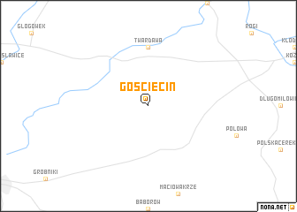
Gościęcin (Poland)Gościęcin is a town in Poland. An overview map of the region around Gościęcin is displayed below.
regional and 3d topo map of Gościęcin, Poland ::
Gościęcin airports ::
The nearest airport is OSR - Ostrava Mosnov, located 65.8 km south of Gościęcin.
Other airports nearby include KTW - Katowice Pyrzowice (79.7 km east), PRV - Prerov (104.5 km south west), WRO - Wroclaw Strachowice (120.4 km north west), KRK - Krakow Balice (129.5 km east), Nearby towns ::
Twardawa (7.4km north) //
[all distances 'as the bird flies' and approximate] 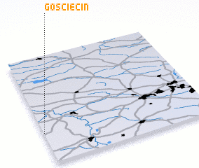 Places with similar names to Gościęcin, Poland ::
Disclaimer :: Information on this page comes without warranty of any kind |
||
|
Where is Gościęcin? Elevation and coordinates ::
Latitude (lat): 50°17'0"N Longitude (lon): 18°0'0"E
Elevation (approx.): 211m (map arrows pan, magnifying glasses zoom) |
||
|
Visiting Gościęcin? Hotel/Accommodation ::
Book a hotel in Gościęcin Travel Guide ::
Buy a travel guide for Poland rental cars ::
car rental offers GPS waypoint ::
download a GPX waypoint (PoI) of Gościęcin for your GPS receiver
|
||