|
search place name
|
||
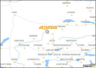
Jazdrowo (Poland)Jazdrowo is a town in Poland. An overview map of the region around Jazdrowo is displayed below.
regional and 3d topo map of Jazdrowo, Poland ::
Jazdrowo airports ::
The nearest airport is POZ - Poznan Lawica, located 116.6 km south of Jazdrowo.
Other airports nearby include OSP - Slupsk Redzikowo (119.4 km north), GDN - Gdansk Lecha Walesy (129.1 km north east), IEG - Zielona Gora Babimost (177.3 km south west), Nearby towns ::
Iłowo (1.1km east) //
Klementynowo (2.2km south east) //
Frydrykowo (3.7km south) //
Jeleń (3.9km south) //
Radońsk (3.8km north east) //
Lubcza Nowa (5.7km south) //
Adamowo (3.8km south west) //
Tobółka Nowa (6.0km south) //
Sypniewo (6.0km south) //
Lubcza (7.4km south) //
Lubcza Stara (7.5km south) //
Zakrzewska Osada (6.5km south east) //
Lutowo (5.8km north east) //
Kolonia Witunia (7.1km south east) //
[all distances 'as the bird flies' and approximate] 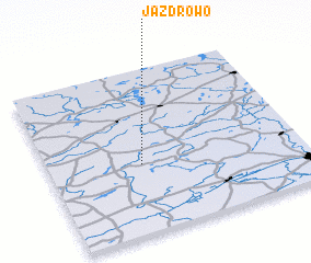
Disclaimer :: Information on this page comes without warranty of any kind |
||
|
Where is Jazdrowo? Elevation and coordinates ::
Latitude (lat): 53°25'0"N Longitude (lon): 17°22'0"E
Elevation (approx.): 125m (map arrows pan, magnifying glasses zoom) |
||
|
Visiting Jazdrowo? Hotel/Accommodation ::
Book a hotel in Jazdrowo Travel Guide ::
Buy a travel guide for Poland rental cars ::
car rental offers GPS waypoint ::
download a GPX waypoint (PoI) of Jazdrowo for your GPS receiver
|
||