|
search place name
|
||
Kiączyn (Poland)Kiączyn is a town in Poland. An overview map of the region around Kiączyn is displayed below.
regional and 3d topo map of Kiączyn, Poland ::

Kiączyn airports ::
The nearest airport is POZ - Poznan Lawica, located 103.6 km north west of Kiączyn.
Other airports nearby include WRO - Wroclaw Strachowice (125.9 km south west), KTW - Katowice Pyrzowice (175.7 km south east), KRK - Krakow Balice (237.3 km south east), Nearby towns ::
Stawiszyn (1.9km south) //
Długa Wieś Druga (1.1km west) //
Petryki (2.3km east) //
Łyczyn (2.3km east) //
Wyrów (3.7km south) //
Leopoldów (3.7km south) //
Długa Wieś (2.3km west) //
Pólko (3.9km south) //
Piątek Mały (3.9km south) //
Zbiersk (3.9km north) //
Marszałki (2.9km north west) //
Złotniki Małe (4.4km south east) //
Ostrówek (4.4km south east) //
Piątek Wielki (4.4km south west) //
Jarantów (3.4km west) //
Kolonia Piątek Mały (5.6km south) //
Brzeziny (3.9km south west) //
Długa Wieś Pierwsza (3.9km south west) //
Kolonia Zbiersk (3.9km north east) //
Grądy Nowe (7.4km north) //
Tykadłów (7.5km south) //
Przyranie (4.9km east) //
Godziątków (4.9km west) //
Wióry (6.5km north west) //
Romanki (6.5km south west) //
Garzew (7.8km south) //
Lubiny (7.8km north) //
Lubin (7.8km north) //
Kolonia Jarantów (5.9km north west) //
[all distances 'as the bird flies' and approximate] 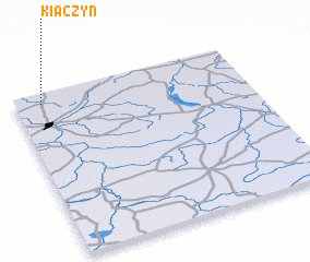 Places with similar names to Kiączyn, Poland ::
Disclaimer :: Information on this page comes without warranty of any kind |
||
|
Where is Kiączyn? Elevation and coordinates ::
Latitude (lat): 51°56'0"N Longitude (lon): 18°7'0"E
Elevation (approx.): 115m (map arrows pan, magnifying glasses zoom) |
||
|
Visiting Kiączyn? Hotel/Accommodation ::
Book a hotel in Kiączyn Travel Guide ::
Buy a travel guide for Poland rental cars ::
car rental offers GPS waypoint ::
download a GPX waypoint (PoI) of Kiączyn for your GPS receiver
|
||