|
search place name
|
||
Kiełków (Poland)Kiełków is a town in Poland. An overview map of the region around Kiełków is displayed below.
regional and 3d topo map of Kiełków, Poland ::

Kiełków airports ::
The nearest airport is RZE - Rzeszow Jasionka, located 41.8 km east of Kiełków.
Other airports nearby include KRK - Krakow Balice (121.4 km west), TAT - Poprad Tatry (156.4 km south west), KSC - Kosice (175.4 km south), WAW - Warsaw Okecie (217.8 km north), Nearby towns ::
Zaborcze (1.9km south) //
Goleszów (1.2km west) //
Rzochów (2.2km north east) //
Przecław (3.7km south) //
Błonie (3.9km south) //
Rżyska (3.9km north) //
Poręby Wojsławskie (3.9km north) //
Książnice (3.0km north west) //
Wojsław (3.9km north) //
Zawierzbie (4.4km north west) //
Podole (5.6km south) //
Wólka (3.6km west) //
Smoczka (5.6km north) //
Rzemień (4.0km south east) //
Poręby Cyranowskie (5.7km north) //
Tuszyma (5.1km south east) //
Podleszany (5.1km north west) //
Cyranka (7.4km north) //
Dąbie (7.5km south) //
Męciszów (7.5km south) //
Wylów (5.1km west) //
Mielec (6.6km north west) //
Dobrynin (6.0km south east) //
Strachów (7.8km south) //
Tarnowiec (6.0km north west) //
Biały Bór (7.3km south east) //
Borek (8.2km north west) //
[all distances 'as the bird flies' and approximate] 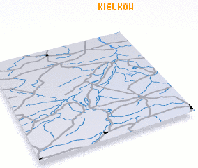 Places with similar names to Kiełków, Poland ::
Disclaimer :: Information on this page comes without warranty of any kind |
||
|
Where is Kiełków? Elevation and coordinates ::
Latitude (lat): 50°14'0"N Longitude (lon): 21°28'0"E
Elevation (approx.): 171m (map arrows pan, magnifying glasses zoom) |
||
|
Visiting Kiełków? Hotel/Accommodation ::
Book a hotel in Kiełków Travel Guide ::
Buy a travel guide for Poland rental cars ::
car rental offers GPS waypoint ::
download a GPX waypoint (PoI) of Kiełków for your GPS receiver
|
||