|
search place name
|
||
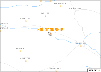
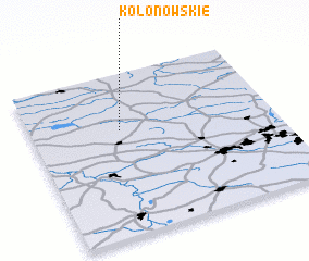
Kolonowskie (Poland)Kolonowskie is a town in Poland. An overview map of the region around Kolonowskie is displayed below.
regional and 3d topo map of Kolonowskie, Poland ::
Kolonowskie airports ::
The nearest airport is KTW - Katowice Pyrzowice, located 54.2 km east of Kolonowskie.
Other airports nearby include OSR - Ostrava Mosnov (107.6 km south), WRO - Wroclaw Strachowice (115.8 km north west), KRK - Krakow Balice (119.3 km south east), PRV - Prerov (152.6 km south west), Nearby towns ::
 Places with similar names to Kolonowskie, Poland ::
// Glinzig (DE)
// Kleinaschau (DE)
// Kleinaschau (DE)
// Gul Nazki (IQ)
// Gliniska (PL)
// Gliniska (PL)
// Glińsko (PL)
// Goleńsko (PL)
// Golińsk (PL)
// Kaleńsko (PL)
Disclaimer :: Information on this page comes without warranty of any kind |
||
|
Where is Kolonowskie? Elevation and coordinates ::
Latitude (lat): 50°39'0"N Longitude (lon): 18°22'0"E
Elevation (approx.): 194m (map arrows pan, magnifying glasses zoom) |
||
|
Visiting Kolonowskie? Hotel/Accommodation ::
Book a hotel in Kolonowskie Travel Guide ::
Buy a travel guide for Poland rental cars ::
car rental offers GPS waypoint ::
download a GPX waypoint (PoI) of Kolonowskie for your GPS receiver
|
||