|
search place name
|
||
Kozłowo (Poland)Kozłowo is a town in Poland. An overview map of the region around Kozłowo is displayed below.
regional and 3d topo map of Kozłowo, Poland ::

Kozłowo airports ::
The nearest airport is POZ - Poznan Lawica, located 27.1 km north east of Kozłowo.
Other airports nearby include IEG - Zielona Gora Babimost (49.8 km south west), WRO - Wroclaw Strachowice (138.1 km south), SZZ - Szczechin Goleniow (176.0 km north west), BBJ - Bautzen (183.5 km south west), Nearby towns ::
Wojnowice (1.9km north) //
Łagwy (3.9km north) //
Uścięcice (3.9km south) //
Opalenica (2.9km south west) //
Troszczyn (4.3km south west) //
Szewce (3.4km east) //
Pawłówko (5.6km north) //
Wiktorowo (5.7km north) //
Niegolewo (5.7km north) //
Dakowy Mokre (6.0km south) //
Rudniki (5.0km north west) //
Dakowy Suche (5.0km south east) //
Woźniki (7.4km south) //
Dobieżyn (4.9km east) //
Snowidowo (7.5km south) //
Buk (5.9km north east) //
Drużyn (7.8km south) //
Urbanowo (7.2km south west) //
Wysoczka (8.7km north east) //
Zegowo (8.7km north east) //
Strzelce (8.7km south west) //
[all distances 'as the bird flies' and approximate] 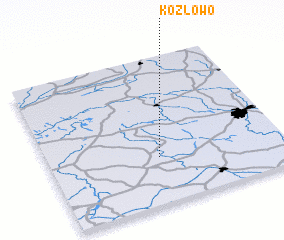 Places with similar names to Kozłowo, Poland ::
Disclaimer :: Information on this page comes without warranty of any kind |
||
|
Where is Kozłowo? Elevation and coordinates ::
Latitude (lat): 52°19'0"N Longitude (lon): 16°28'0"E
Elevation (approx.): 77m (map arrows pan, magnifying glasses zoom) |
||
|
Visiting Kozłowo? Hotel/Accommodation ::
Book a hotel in Kozłowo Travel Guide ::
Buy a travel guide for Poland rental cars ::
car rental offers GPS waypoint ::
download a GPX waypoint (PoI) of Kozłowo for your GPS receiver
|
||