|
search place name
|
||
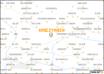
Kroczymiech (Poland)Kroczymiech is a town in Poland. An overview map of the region around Kroczymiech is displayed below.
regional and 3d topo map of Kroczymiech, Poland ::
Kroczymiech airports ::
The nearest airport is KRK - Krakow Balice, located 30.5 km east of Kroczymiech.
Other airports nearby include KTW - Katowice Pyrzowice (43.1 km north west), OSR - Ostrava Mosnov (102.4 km south west), TAT - Poprad Tatry (133.7 km south east), PRV - Prerov (161.7 km south west), Nearby towns ::
Balin Mały (1.9km north) //
Borowiec (2.2km south east) //
Kąty (2.2km north east) //
Chrzanów (2.4km east) //
Jaworek (3.9km south) //
Balin Duży (3.9km north) //
Luszowice (4.4km north east) //
Kościelec (3.6km east) //
Balin (5.7km north) //
Żarki (5.7km south) //
Cezarówka Górna (5.7km north) //
Zagórze (6.0km south east) //
Pogorzyce (5.1km south east) //
Skotnica (5.1km south west) //
Libiąż (5.1km south west) //
Libiąż Mały (5.1km south west) //
Piaski (6.0km north east) //
Moczydło (6.0km south west) //
Byczyna (5.1km north west) //
Bereska (5.1km east) //
Góry Luszowskie (6.6km north east) //
Zrebce (6.0km south east) //
Wodna (6.0km north east) //
Libiąż Wielki (6.0km south west) //
Bory Pastwiska (7.3km north west) //
Misiury (8.2km north east) //
Szyjki (8.8km south west) //
Siersza (8.8km north east) //
Huta (8.8km north east) //
[all distances 'as the bird flies' and approximate]  Places with similar names to Kroczymiech, Poland :: Disclaimer :: Information on this page comes without warranty of any kind |
||
|
Where is Kroczymiech? Elevation and coordinates ::
Latitude (lat): 50°8'0"N Longitude (lon): 19°22'0"E
Elevation (approx.): 281m (map arrows pan, magnifying glasses zoom) |
||
|
Visiting Kroczymiech? Hotel/Accommodation ::
Book a hotel in Kroczymiech Travel Guide ::
Buy a travel guide for Poland rental cars ::
car rental offers GPS waypoint ::
download a GPX waypoint (PoI) of Kroczymiech for your GPS receiver
|
||