|
search place name
|
||
Łapy Osse (Poland)Łapy Osse is a town in Poland. An overview map of the region around Łapy Osse is displayed below.
regional and 3d topo map of Łapy Osse, Poland ::

Łapy Osse airports ::
The nearest airport is WAW - Warsaw Okecie, located 155.8 km south west of Łapy Osse.
Nearby towns ::
Płonka Kościelna (1.9km north) //
Płonka (1.9km north) //
Płonka Strumianka (1.9km north) //
Płonka Kozły (2.2km north west) //
Gąsówka Skwarki (2.2km west) //
Płonka Matyski (2.2km west) //
Łapy Zięciuki (2.2km east) //
Łapy Łynki (2.2km east) //
Łapy (2.2km east) //
Kamieńskie Ocioski (3.9km south) //
Łapy Kołpaki (2.9km south east) //
Zdrody Stare (4.3km south west) //
Roszki Włodki (4.3km north west) //
Poświętne (5.6km south) //
Łupianka Nowa (5.6km north) //
Dzierzki Wojciechowięta (5.7km south) //
Perki Wypychy (3.8km south west) //
Łapy Korczaki (3.8km south east) //
Grochy (5.7km south) //
Grochy Niemierzęta (5.7km south) //
Grochy Stare (5.7km south) //
Dzierzki (6.0km south) //
Dzierzki Janowięta (6.0km south) //
Daniłowo Małe (5.0km south east) //
Zdrody Nowe (5.0km south west) //
Gąsówka Małe (5.0km south east) //
Zdrody (5.0km south west) //
Gąsówka Oleksin (5.0km south east) //
Roszki (6.0km north) //
[all distances 'as the bird flies' and approximate] 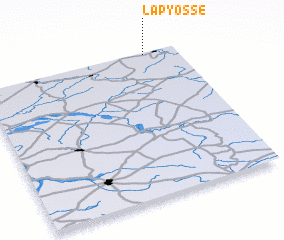 Places with similar names to Łapy Osse, Poland :: Disclaimer :: Information on this page comes without warranty of any kind |
||
|
Where is Łapy Osse? Elevation and coordinates ::
Latitude (lat): 52°59'0"N Longitude (lon): 22°50'0"E
Elevation (approx.): 125m (map arrows pan, magnifying glasses zoom) |
||
|
Visiting Łapy Osse? Hotel/Accommodation ::
Book a hotel in Łapy Osse Travel Guide ::
Buy a travel guide for Poland rental cars ::
car rental offers GPS waypoint ::
download a GPX waypoint (PoI) of Łapy Osse for your GPS receiver
|
||