|
search place name
|
||
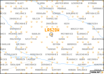
Łaszów (Poland)Łaszów is a town in Poland. An overview map of the region around Łaszów is displayed below.
regional and 3d topo map of Łaszów, Poland ::
Łaszów airports ::
The nearest airport is KRK - Krakow Balice, located 45.5 km south west of Łaszów.
Other airports nearby include KTW - Katowice Pyrzowice (93.3 km west), RZE - Rzeszow Jasionka (120.5 km east), TAT - Poprad Tatry (132.9 km south), KSC - Kosice (189.7 km south), Nearby towns ::
Bolów (1.2km west) //
Czuszów (1.9km south) //
Kadzice (2.2km south east) //
Zakrzówek (3.7km north) //
Małoszów (2.4km east) //
Baranów (3.9km north) //
Zakrzów (3.9km north) //
Winiary (3.9km north) //
Gunów (3.0km south east) //
Nadzów (3.0km south west) //
Ostrów (3.9km south) //
Klimontów (3.9km south) //
Pałecznica (4.4km north west) //
Góry Sieradzkie (4.4km south east) //
Głuchów (3.6km east) //
Przybenice (3.6km east) //
Tempoczów (5.6km north) //
Sudołek (3.6km west) //
Teresin (5.6km south) //
Posiłów (5.7km south) //
Kózki (5.1km north east) //
Niezwojowice (6.0km north west) //
Bronocice (7.4km north) //
Przezwody (7.4km south) //
Stagniowice (7.4km south) //
Gruszów (4.7km west) //
Szarbia (7.5km north) //
Marcinów (7.5km north) //
Pieczonogi (5.1km west) //
[all distances 'as the bird flies' and approximate]  Places with similar names to Łaszów, Poland ::
Disclaimer :: Information on this page comes without warranty of any kind |
||
|
Where is Łaszów? Elevation and coordinates ::
Latitude (lat): 50°16'0"N Longitude (lon): 20°21'0"E
Elevation (approx.): 266m (map arrows pan, magnifying glasses zoom) |
||
|
Visiting Łaszów? Hotel/Accommodation ::
Book a hotel in Łaszów Travel Guide ::
Buy a travel guide for Poland rental cars ::
car rental offers GPS waypoint ::
download a GPX waypoint (PoI) of Łaszów for your GPS receiver
|
||