|
search place name
|
||
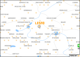
Leśno (Poland)Leśno is a town in Poland. An overview map of the region around Leśno is displayed below.
regional and 3d topo map of Leśno, Poland ::
Leśno airports ::
The nearest airport is GDN - Gdansk Lecha Walesy, located 13.5 km south east of Leśno.
Other airports nearby include OSP - Slupsk Redzikowo (77.4 km west), Nearby towns ::
Kieleńska Huta (1.9km north) //
Kłosówko (2.1km south west) //
Bieszkówko (3.7km north) //
Warzeńska Huta (2.2km east) //
Kowalewo (2.2km west) //
Kłosowo (3.7km south) //
Kamień (4.3km north west) //
Tokary (4.3km south east) //
Czeczewo (4.3km south east) //
Warzno (3.2km east) //
Rąb (3.2km west) //
Kielno (3.2km east) //
Jeleńska Huta (3.7km north west) //
Kawle Dolne (5.7km south) //
Kawle Górne (5.7km south) //
Koleczkowo (4.9km north east) //
Szemudska Huta (4.7km north west) //
Warzenko (4.7km south east) //
Bieszkowice (7.5km north) //
Przodkowo (7.5km south) //
Szemud (5.7km north west) //
Myszewko (5.7km south east) //
Kczewo (7.7km south) //
Grabowiec (8.1km north west) //
Załęże (7.0km south west) //
Myszewo (7.0km south east) //
Kosowo (8.1km south west) //
Szarłata (8.6km south west) //
[all distances 'as the bird flies' and approximate]  Places with similar names to Leśno, Poland ::
Disclaimer :: Information on this page comes without warranty of any kind |
||
|
Where is Leśno? Elevation and coordinates ::
Latitude (lat): 54°27'0"N Longitude (lon): 18°18'0"E
Elevation (approx.): 227m (map arrows pan, magnifying glasses zoom) |
||
|
Visiting Leśno? Hotel/Accommodation ::
Book a hotel in Leśno Travel Guide ::
Buy a travel guide for Poland rental cars ::
car rental offers GPS waypoint ::
download a GPX waypoint (PoI) of Leśno for your GPS receiver
|
||