|
search place name
|
||
Lgota (Poland)Lgota is a town in Poland. An overview map of the region around Lgota is displayed below.
regional and 3d topo map of Lgota, Poland ::

Lgota airports ::
The nearest airport is KTW - Katowice Pyrzowice, located 59.4 km south of Lgota.
Other airports nearby include KRK - Krakow Balice (105.7 km south), OSR - Ostrava Mosnov (167.5 km south west), WAW - Warsaw Okecie (173.6 km north east), PRV - Prerov (221.3 km south west), Nearby towns ::
Jacków (1.9km south) //
Baby (2.2km south west) //
Pieńki (2.2km north east) //
Kolonia Zdrowa (3.9km south) //
Wilkłów (3.0km north west) //
Szczepocice (3.9km north) //
Widzówek (3.5km east) //
Teklinów (3.5km east) //
Szczepocice Królewskie (5.6km north) //
Zdrowa (5.7km south) //
Widzów (4.0km south east) //
Kruszyna (4.0km south west) //
Łęg (6.0km north west) //
Kłomnice (6.0km south east) //
Witkowice (7.5km south) //
Nieznanice (7.5km south) //
Aurelów (7.5km south) //
Borowno (6.6km south west) //
Lipicze (6.6km south east) //
Dąbrówka (6.6km north east) //
Bogusławice (6.0km south west) //
Michałów (7.8km south) //
Brodowe (7.8km north) //
Bartkowice (8.2km south east) //
Kijów (7.3km north west) //
Jankowice (8.8km north west) //
[all distances 'as the bird flies' and approximate] 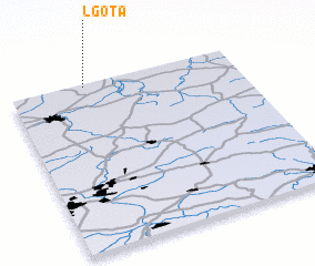 Places with similar names to Lgota, Poland ::
Disclaimer :: Information on this page comes without warranty of any kind |
||
|
Where is Lgota? Elevation and coordinates ::
Latitude (lat): 50°59'0"N Longitude (lon): 19°20'0"E
Elevation (approx.): 218m (map arrows pan, magnifying glasses zoom) |
||
|
Visiting Lgota? Hotel/Accommodation ::
Book a hotel in Lgota Travel Guide ::
Buy a travel guide for Poland rental cars ::
car rental offers GPS waypoint ::
download a GPX waypoint (PoI) of Lgota for your GPS receiver
|
||