|
search place name
|
||
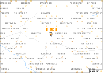
Mirów (Poland)Mirów is a town in Poland. An overview map of the region around Mirów is displayed below.
regional and 3d topo map of Mirów, Poland ::
Mirów airports ::
The nearest airport is KTW - Katowice Pyrzowice, located 31.7 km south west of Mirów.
Other airports nearby include KRK - Krakow Balice (64.1 km south), OSR - Ostrava Mosnov (140.9 km south west), TAT - Poprad Tatry (180.4 km south), WAW - Warsaw Okecie (201.5 km north east), Nearby towns ::
Kotowice (1.9km south) //
Lutowiec (2.2km north west) //
Ogorzelnik (2.4km east) //
Bobolice (2.4km east) //
Niegowa (3.9km north) //
Moczydło (3.9km north) //
Hucisko (3.0km south east) //
Rzędkowice (3.9km south) //
Góra Włodowska (3.9km south) //
Jaworznik (3.5km west) //
Postaszowice (5.7km north) //
Tomiszowice (5.1km north east) //
Mzurów (6.0km north east) //
Trzebniów (6.0km north west) //
Gorzków Nowy (7.4km north) //
Parkoszowice (7.4km south) //
Gorzków Stary (7.5km north) //
Zdów (5.1km east) //
Ludwinów (7.5km north) //
Włodowice (7.5km south) //
Morsko (7.8km south) //
Podlesice (7.3km south east) //
Czatachowa (7.3km north west) //
[all distances 'as the bird flies' and approximate]  Places with similar names to Mirów, Poland ::
Disclaimer :: Information on this page comes without warranty of any kind |
||
|
Where is Mirów? Elevation and coordinates ::
Latitude (lat): 50°37'0"N Longitude (lon): 19°28'0"E
Elevation (approx.): 345m (map arrows pan, magnifying glasses zoom) |
||
|
Visiting Mirów? Hotel/Accommodation ::
Book a hotel in Mirów Travel Guide ::
Buy a travel guide for Poland rental cars ::
car rental offers GPS waypoint ::
download a GPX waypoint (PoI) of Mirów for your GPS receiver
|
||