|
search place name
|
||
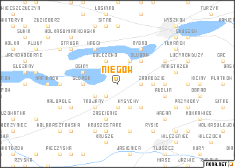
Niegów (Poland)Niegów is a town in Poland. An overview map of the region around Niegów is displayed below.
regional and 3d topo map of Niegów, Poland ::
Niegów airports ::
The nearest airport is WAW - Warsaw Okecie, located 48.3 km south west of Niegów.
Nearby towns ::
Młynarze (2.2km north west) //
Lasków Kochowo (2.2km south west) //
Gaj (2.3km east) //
Lasków Głuchy (3.7km south) //
Lasków (3.7km south) //
Gulczewo (3.9km north) //
Grądy (3.9km north) //
Jakuszewo Janowo (2.9km south west) //
Wysychy (3.9km south) //
Deskurów (4.3km north east) //
Ślubów (4.3km north east) //
Trojany (4.3km south west) //
Dębinki (4.3km south east) //
Słopsk (3.4km west) //
Zabrodzie (3.4km east) //
Osiny (3.9km north west) //
Zaścienie (5.7km south) //
Kręgi (6.0km north) //
Rybno (6.0km north) //
Mostówka (4.5km east) //
Krusze Stare (7.5km south) //
Krusze Nowe (7.5km south) //
Kozły (7.5km south) //
Adelin (4.9km east) //
Dąbrówka (5.8km south west) //
Karpin (5.8km south west) //
Lucynów Mały (5.8km north east) //
Chruściele Nowe (7.7km south) //
Struga (7.2km north west) //
[all distances 'as the bird flies' and approximate] 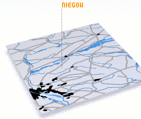 Places with similar names to Niegów, Poland ::
Disclaimer :: Information on this page comes without warranty of any kind |
||
|
Where is Niegów? Elevation and coordinates ::
Latitude (lat): 52°31'0"N Longitude (lon): 21°23'0"E
Elevation (approx.): 84m (map arrows pan, magnifying glasses zoom) |
||
|
Visiting Niegów? Hotel/Accommodation ::
Book a hotel in Niegów Travel Guide ::
Buy a travel guide for Poland rental cars ::
car rental offers GPS waypoint ::
download a GPX waypoint (PoI) of Niegów for your GPS receiver
|
||