|
search place name
|
||
Olchowo (Poland)Olchowo is a town in Poland. An overview map of the region around Olchowo is displayed below.
regional and 3d topo map of Olchowo, Poland ::

Olchowo airports ::
The nearest airport is POZ - Poznan Lawica, located 81.1 km west of Olchowo.
Other airports nearby include WRO - Wroclaw Strachowice (141.0 km south west), KTW - Katowice Pyrzowice (205.8 km south east), Nearby towns ::
Dolany (1.9km north) //
Oleśnica (2.2km south west) //
Skokum (2.2km south east) //
Trąbczyn (3.7km south) //
Kopojno (2.9km south east) //
Lądek (3.9km north) //
Wola Koszucka (5.6km north) //
Zagórów (3.9km south west) //
Ratyń (3.9km north east) //
Nowa Wieś (5.7km south) //
Osiny (5.7km south) //
Piotrowo (6.0km north) //
Drzewce (5.0km south west) //
Michalinów (6.0km south) //
Ląd (5.0km north west) //
Łazy (7.4km south) //
Tarszewo (4.5km east) //
Michalinów (7.5km south) //
Chruściki (4.9km east) //
Sługocin (4.9km east) //
Wacławów (6.5km north east) //
Szetlew (6.5km south east) //
Podbiel (6.5km south east) //
Stanisławów (7.8km south) //
Kowalewo Opactwo (7.8km north) //
Goździków (5.9km south east) //
Szetlewek (8.2km south east) //
Jaroszyn (7.2km north west) //
Kowalewo Sołectwo (8.2km north west) //
[all distances 'as the bird flies' and approximate] 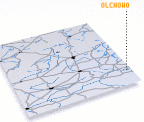
Disclaimer :: Information on this page comes without warranty of any kind |
||
|
Where is Olchowo? Elevation and coordinates ::
Latitude (lat): 52°11'0"N Longitude (lon): 17°57'0"E
Elevation (approx.): 73m (map arrows pan, magnifying glasses zoom) |
||
|
Visiting Olchowo? Hotel/Accommodation ::
Book a hotel in Olchowo Travel Guide ::
Buy a travel guide for Poland rental cars ::
car rental offers GPS waypoint ::
download a GPX waypoint (PoI) of Olchowo for your GPS receiver
|
||