|
search place name
|
||
Ostrowo (Poland)Ostrowo is a town in Poland. An overview map of the region around Ostrowo is displayed below.
regional and 3d topo map of Ostrowo, Poland ::

Ostrowo airports ::
The nearest airport is GDN - Gdansk Lecha Walesy, located 123.4 km north of Ostrowo.
Other airports nearby include POZ - Poznan Lawica (162.1 km south west), OSP - Slupsk Redzikowo (172.1 km north west), KGD - Kaliningrad Khrabrovo (215.1 km north east), Nearby towns ::
Płużnica (2.2km north east) //
Bielawy (2.2km north west) //
Czaple (3.3km east) //
Kotnowo (5.7km north) //
Wieldządz (6.0km north) //
Dąbrówka pod Gorzuchowem (6.0km north) //
Zajączkowo (7.4km south) //
Błędowo (7.4km north) //
Sztrucfon (4.4km west) //
Lisewo (4.8km north west) //
Malankowo (6.5km north west) //
Trzciano (5.8km south east) //
Węgorzyn (7.7km south) //
Dźwierzno (7.7km south) //
Drzonowo (5.8km south west) //
Nowawieś Królewska (7.1km north east) //
Zelgno (8.1km south west) //
Ryńsk (7.1km south east) //
Liznowo (7.1km south west) //
Krajęcin (8.6km north west) //
[all distances 'as the bird flies' and approximate] 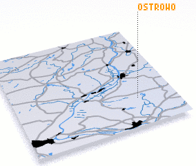 Places with similar names to Ostrowo, Poland ::
Disclaimer :: Information on this page comes without warranty of any kind |
||
|
Where is Ostrowo? Elevation and coordinates ::
Latitude (lat): 53°17'0"N Longitude (lon): 18°46'0"E
Elevation (approx.): 96m (map arrows pan, magnifying glasses zoom) |
||
|
Visiting Ostrowo? Hotel/Accommodation ::
Book a hotel in Ostrowo Travel Guide ::
Buy a travel guide for Poland rental cars ::
car rental offers GPS waypoint ::
download a GPX waypoint (PoI) of Ostrowo for your GPS receiver
|
||