|
search place name
|
||
Pączewo (Poland)Pączewo is a town in Poland. An overview map of the region around Pączewo is displayed below.
regional and 3d topo map of Pączewo, Poland ::

Pączewo airports ::
The nearest airport is GDN - Gdansk Lecha Walesy, located 58.9 km north of Pączewo.
Other airports nearby include OSP - Slupsk Redzikowo (116.5 km north west), POZ - Poznan Lawica (195.8 km south west), Nearby towns ::
Wolental (2.2km south east) //
Czarnylas (2.2km west) //
Wysoka (3.9km north) //
Bobowo (4.3km north east) //
Grabowo (3.3km east) //
Skórcz (5.6km south) //
Wielki Bukowiec (3.8km south west) //
Ryzowie (5.7km south) //
Bukowiec Nowy (5.0km south west) //
Wielbrandowo (5.0km south east) //
Dąbrówka (7.4km north) //
Mieliczki (7.5km south) //
Brzeźno (4.7km north east) //
Maksymilianowo (4.8km south east) //
Lipinki Królewskie (6.5km north west) //
Zajączek (6.5km south west) //
Miryce (6.5km south east) //
Zielona Góra (5.7km north west) //
Głuche (7.7km south) //
Jabłówko (7.7km north) //
Brzeziny (7.1km north west) //
[all distances 'as the bird flies' and approximate] 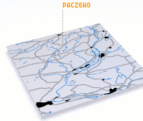
Disclaimer :: Information on this page comes without warranty of any kind |
||
|
Where is Pączewo? Elevation and coordinates ::
Latitude (lat): 53°51'0"N Longitude (lon): 18°32'0"E
Elevation (approx.): 83m (map arrows pan, magnifying glasses zoom) |
||
|
Visiting Pączewo? Hotel/Accommodation ::
Book a hotel in Pączewo Travel Guide ::
Buy a travel guide for Poland rental cars ::
car rental offers GPS waypoint ::
download a GPX waypoint (PoI) of Pączewo for your GPS receiver
|
||