|
search place name
|
||
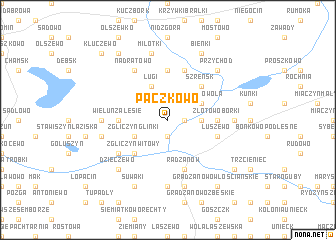
Pączkowo (Poland)Pączkowo is a town in Poland. An overview map of the region around Pączkowo is displayed below.
regional and 3d topo map of Pączkowo, Poland ::
Pączkowo airports ::
The nearest airport is WAW - Warsaw Okecie, located 108.9 km south east of Pączkowo.
Other airports nearby include GDN - Gdansk Lecha Walesy (188.4 km north west), KGD - Kaliningrad Khrabrovo (214.8 km north), Nearby towns ::
Ratowo (1.9km south) //
Bielawy (1.1km east) //
Złotowo (2.2km east) //
Zgliczyn Glinki (2.9km south west) //
Ługi (3.9km north) //
Złotowo Wola (2.9km north east) //
Zgliczyn Witowy (4.3km south west) //
Szreńsk (4.3km north east) //
Wieluń (3.3km west) //
Złotowo Borki (3.3km east) //
Wieluń Zalesie (3.3km west) //
Garkowo Stare (5.6km north) //
Luszewo (3.8km south east) //
Radzanów (5.7km south) //
Garkowo Nowe (5.7km north) //
Zgliczyn Pobodzy (5.0km south west) //
Nadratowo (6.0km north) //
Bojanowo (7.4km south) //
Wieluń Pełki (4.5km west) //
Wróblewo Tartak (4.5km east) //
Wieluń Wilewo (4.8km south west) //
Bębnowo (7.5km south) //
Miłotki (7.5km north) //
Dzieczewo (6.5km south west) //
Przychód (6.5km north east) //
Suwaki (7.7km south) //
Bieńki (7.7km north) //
Gradzanowo Włościańskie (8.1km south east) //
Józefowo (7.1km south east) //
[all distances 'as the bird flies' and approximate] 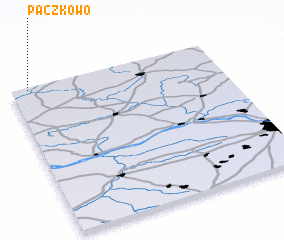 Places with similar names to Pączkowo, Poland ::
// Pieczkowo (PL)
Disclaimer :: Information on this page comes without warranty of any kind |
||
|
Where is Pączkowo? Elevation and coordinates ::
Latitude (lat): 52°59'0"N Longitude (lon): 20°5'0"E
Elevation (approx.): 111m (map arrows pan, magnifying glasses zoom) |
||
|
Visiting Pączkowo? Hotel/Accommodation ::
Book a hotel in Pączkowo Travel Guide ::
Buy a travel guide for Poland rental cars ::
car rental offers GPS waypoint ::
download a GPX waypoint (PoI) of Pączkowo for your GPS receiver
|
||