|
search place name
|
||
Pełty (Poland)Pełty is a town in Poland. An overview map of the region around Pełty is displayed below.
regional and 3d topo map of Pełty, Poland ::

Pełty airports ::
The nearest airport is WAW - Warsaw Okecie, located 140.5 km south of Pełty.
Other airports nearby include KGD - Kaliningrad Khrabrovo (169.5 km north), Nearby towns ::
Wujaki (2.9km north east) //
Maciejowa Szyja (2.9km south east) //
Świdwiborek (3.9km south) //
Nowy Suchoros (5.6km north) //
Księży Lasek (3.3km west) //
Brzozowy Kąt (5.7km south) //
Orzeszki (5.7km north) //
Radostowo (6.0km north) //
Klon (6.0km north) //
Cyk (5.0km south west) //
Suchorowiec (4.4km west) //
Charciabałda Budy (7.5km south) //
Czarnia (6.5km south west) //
Charciabałda (7.7km south) //
Ruchaje (5.8km south west) //
Kiełbasy (8.1km north west) //
Mikołajewo (7.1km south west) //
Białusny Lasek (7.1km south east) //
[all distances 'as the bird flies' and approximate] 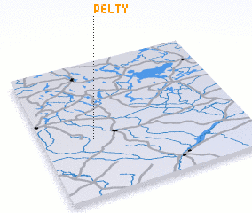 Places with similar names to Pełty, Poland ::
Disclaimer :: Information on this page comes without warranty of any kind |
||
|
Where is Pełty? Elevation and coordinates ::
Latitude (lat): 53°25'0"N Longitude (lon): 21°15'0"E
Elevation (approx.): 137m (map arrows pan, magnifying glasses zoom) |
||
|
Visiting Pełty? Hotel/Accommodation ::
Book a hotel in Pełty Travel Guide ::
Buy a travel guide for Poland rental cars ::
car rental offers GPS waypoint ::
download a GPX waypoint (PoI) of Pełty for your GPS receiver
|
||