|
search place name
|
||
Połoninskie (Poland)Połoninskie is a town in Poland. An overview map of the region around Połoninskie is displayed below.
regional and 3d topo map of Połoninskie, Poland ::

Połoninskie airports ::
The nearest airport is LWO - Lvov Lviv Intl, located 110.6 km north east of Połoninskie.
Other airports nearby include RZE - Rzeszow Jasionka (111.9 km north west), KSC - Kosice (125.5 km south west), SUJ - Satu Mare (168.7 km south), BAY - Baia Mare Tautii Magheraus (181.6 km south), Nearby towns ::
Kłynia (1.9km north) //
Zhuravin (2.2km north west) //
Smolnik (2.4km west) //
Syhły (3.0km north west) //
Dydëva (3.9km south) //
Lutowiska (4.4km north west) //
Posada Dolna (4.4km north west) //
Stuposiany (4.4km south west) //
Bobërka (4.1km south east) //
Krywka (5.7km north) //
Lopushanka (6.1km north east) //
Dwerniczek (5.2km west) //
Procisne (5.2km west) //
Khashchuv (6.6km north east) //
Pszczeliny (7.8km south) //
Łopuszanka Lechniowa (8.3km north east) //
Chodak (8.3km north west) //
Dźwiniacz Górny (8.3km south east) //
Gorishnyy Dzvinyach (8.9km south east) //
[all distances 'as the bird flies' and approximate] 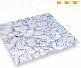 Places with similar names to Połoninskie, Poland :: Disclaimer :: Information on this page comes without warranty of any kind |
||
|
Where is Połoninskie? Elevation and coordinates ::
Latitude (lat): 49°13'0"N Longitude (lon): 22°44'0"E
Elevation (approx.): 580m (map arrows pan, magnifying glasses zoom) |
||
|
Visiting Połoninskie? Hotel/Accommodation ::
Book a hotel in Połoninskie Travel Guide ::
Buy a travel guide for Poland rental cars ::
car rental offers GPS waypoint ::
download a GPX waypoint (PoI) of Połoninskie for your GPS receiver
|
||