|
search place name
|
||
Ponikwa (Poland)Ponikwa is a town in Poland. An overview map of the region around Ponikwa is displayed below.
regional and 3d topo map of Ponikwa, Poland ::

Ponikwa airports ::
The nearest airport is WAW - Warsaw Okecie, located 87.6 km north west of Ponikwa.
Other airports nearby include RZE - Rzeszow Jasionka (155.6 km south), KRK - Krakow Balice (202.1 km south west), Nearby towns ::
Brzustów (1.2km west) //
Bogucin (2.2km north west) //
Dąbrowa Las (3.7km south) //
Garbatka (2.3km east) //
Wygwizdów (2.3km east) //
Anielin (3.0km south west) //
Patków (3.9km south) //
Garbatka-Letnisko (3.0km north east) //
Molendy (3.9km north) //
Policzna (4.4km south east) //
Franków (5.6km south) //
Wólka Policka (3.9km south east) //
Wilcza Wola (5.7km south) //
Antoniówka (5.7km south) //
Krasna Dąbrowa (3.9km north west) //
Helenów (7.4km south) //
Ruda (7.4km north) //
Andrzejówka (7.5km south) //
Garbatka Długa (5.0km east) //
Świetlikowa Wola (6.6km south east) //
Aleksandrówka (7.8km south) //
Kociołki (7.8km north) //
Józefów (8.2km south east) //
Biały Ług (8.2km south east) //
Nowiny (8.2km north west) //
[all distances 'as the bird flies' and approximate] 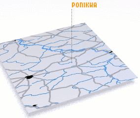 Places with similar names to Ponikwa, Poland ::
Disclaimer :: Information on this page comes without warranty of any kind |
||
|
Where is Ponikwa? Elevation and coordinates ::
Latitude (lat): 51°29'0"N Longitude (lon): 21°36'0"E
Elevation (approx.): 157m (map arrows pan, magnifying glasses zoom) |
||
|
Visiting Ponikwa? Hotel/Accommodation ::
Book a hotel in Ponikwa Travel Guide ::
Buy a travel guide for Poland rental cars ::
car rental offers GPS waypoint ::
download a GPX waypoint (PoI) of Ponikwa for your GPS receiver
|
||