|
search place name
|
||
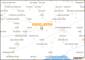
Popielarnia (Poland)Popielarnia is a town in Poland. An overview map of the region around Popielarnia is displayed below.
regional and 3d topo map of Popielarnia, Poland ::
Popielarnia airports ::
The nearest airport is WAW - Warsaw Okecie, located 91.2 km south west of Popielarnia.
Nearby towns ::
Rogóżnia (1.1km east) //
Lipniki (1.1km west) //
Sielc (2.2km north west) //
Komorowo (4.3km north east) //
Nagoszewo (4.3km south west) //
Turka (5.6km south) //
Laskowizna (5.6km south) //
Koziki (3.4km west) //
Stok (5.6km north) //
Grabownica Nowa (6.0km south) //
Legionowo (5.0km north east) //
Grądy (5.0km north west) //
Koziki Majdan (4.5km west) //
Puzdrowizna (7.4km south) //
Jelenie (7.4km north) //
Fidury (4.9km west) //
Grabownica Stara (5.8km south east) //
Lubiejewo Stare (5.8km north east) //
Lubiejewo (7.1km north east) //
Rynek (7.1km north west) //
Zakrzewek (8.7km north east) //
[all distances 'as the bird flies' and approximate] 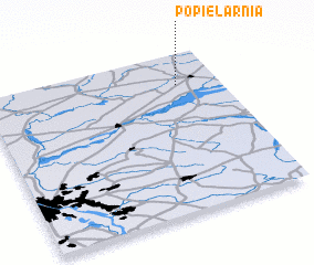 Places with similar names to Popielarnia, Poland ::
Disclaimer :: Information on this page comes without warranty of any kind |
||
|
Where is Popielarnia? Elevation and coordinates ::
Latitude (lat): 52°48'0"N Longitude (lon): 21°49'0"E
Elevation (approx.): 116m (map arrows pan, magnifying glasses zoom) |
||
|
Visiting Popielarnia? Hotel/Accommodation ::
Book a hotel in Popielarnia Travel Guide ::
Buy a travel guide for Poland rental cars ::
car rental offers GPS waypoint ::
download a GPX waypoint (PoI) of Popielarnia for your GPS receiver
|
||