|
search place name
|
||
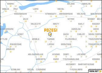
Pożegi (Poland)Pożegi is a town in Poland. An overview map of the region around Pożegi is displayed below.
regional and 3d topo map of Pożegi, Poland ::
Pożegi airports ::
The nearest airport is WAW - Warsaw Okecie, located 166.8 km south west of Pożegi.
Other airports nearby include KGD - Kaliningrad Khrabrovo (172.4 km north west), Nearby towns ::
Turowo (1.9km south) //
Zawady (1.9km north) //
Liski (2.2km north east) //
Rakówko (2.2km south west) //
Bogumiły (2.2km north west) //
Lipniki (3.7km south) //
Masty (3.9km north) //
Guzki (3.3km east) //
Wróble (3.8km south west) //
Grodzisko (5.0km south east) //
Kałęczyn (5.0km north west) //
Gruzy (4.4km east) //
Stare Guty (7.4km north) //
Filipki Małe (4.8km south east) //
Bagieńskie (4.8km north east) //
Bialiki (7.5km south) //
Wykowo (7.5km south) //
Brzozowo (7.5km south) //
Pietrzyki (7.5km north) //
Dziadowo (4.8km south west) //
Filipki Duże (5.8km south east) //
Jeże (7.7km south) //
Szymki (7.1km north east) //
Żebry (8.1km south east) //
Wolisko Wielkie (8.1km south west) //
Górskie (8.1km south east) //
Rakowo Piskie (8.1km north east) //
Okurowo (8.6km south east) //
Danowo (8.6km south east) //
[all distances 'as the bird flies' and approximate] 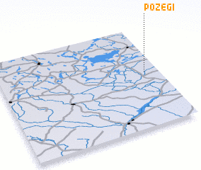 Places with similar names to Pożegi, Poland ::
Disclaimer :: Information on this page comes without warranty of any kind |
||
|
Where is Pożegi? Elevation and coordinates ::
Latitude (lat): 53°33'0"N Longitude (lon): 21°55'0"E
Elevation (approx.): 141m (map arrows pan, magnifying glasses zoom) |
||
|
Visiting Pożegi? Hotel/Accommodation ::
Book a hotel in Pożegi Travel Guide ::
Buy a travel guide for Poland rental cars ::
car rental offers GPS waypoint ::
download a GPX waypoint (PoI) of Pożegi for your GPS receiver
|
||