|
search place name
|
||
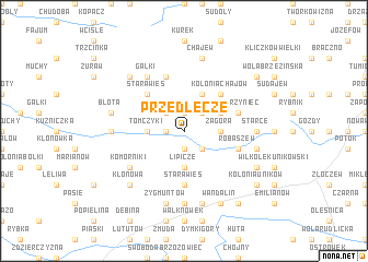
Przedłęcze (Poland)Przedłęcze is a town in Poland. An overview map of the region around Przedłęcze is displayed below.
regional and 3d topo map of Przedłęcze, Poland ::
Przedłęcze airports ::
The nearest airport is KTW - Katowice Pyrzowice, located 118.1 km south of Przedłęcze.
Other airports nearby include WRO - Wroclaw Strachowice (118.6 km west), POZ - Poznan Lawica (155.7 km north west), KRK - Krakow Balice (179.7 km south east), OSR - Ostrava Mosnov (198.7 km south), Nearby towns ::
Pluty (1.9km north) //
Sokolenie (1.2km west) //
Sowizdrzały (1.9km south) //
Ciołki (2.2km north west) //
Zadębiniec (2.2km north east) //
Lesiaki (2.2km south east) //
Tomczyki (2.3km west) //
Zagóra (2.3km east) //
Godyniece (2.3km east) //
Lipicze (3.7km south) //
Czartoria (3.9km north) //
Zagórce (3.0km north east) //
Brąszewice (4.4km north west) //
Stara Wieś (4.4km north west) //
Kolonia Chajów (4.4km north east) //
Stara Wieś (5.6km south) //
Zwierzyniec (3.9km north east) //
Brąszewice Przyczałki (5.7km north) //
Robaszew (3.9km south east) //
Gałki (6.0km north west) //
Komorniki (5.1km south west) //
Kuźnica Błońska (4.6km west) //
Owieczki (7.4km south) //
Starce (4.6km east) //
Błota (5.0km west) //
Chajew (7.5km north) //
Bukowiec (7.5km north) //
Zygmuntów (7.5km south) //
Grójec Wielki (5.0km east) //
[all distances 'as the bird flies' and approximate] 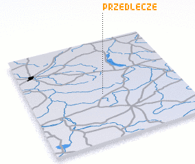 Places with similar names to Przedłęcze, Poland :: Disclaimer :: Information on this page comes without warranty of any kind |
||
|
Where is Przedłęcze? Elevation and coordinates ::
Latitude (lat): 51°28'0"N Longitude (lon): 18°29'0"E
Elevation (approx.): 162m (map arrows pan, magnifying glasses zoom) |
||
|
Visiting Przedłęcze? Hotel/Accommodation ::
Book a hotel in Przedłęcze Travel Guide ::
Buy a travel guide for Poland rental cars ::
car rental offers GPS waypoint ::
download a GPX waypoint (PoI) of Przedłęcze for your GPS receiver
|
||