|
search place name
|
||
Przetoczyno (Poland)Przetoczyno is a town in Poland. An overview map of the region around Przetoczyno is displayed below.
regional and 3d topo map of Przetoczyno, Poland ::

Przetoczyno airports ::
The nearest airport is GDN - Gdansk Lecha Walesy, located 23.7 km south east of Przetoczyno.
Other airports nearby include OSP - Slupsk Redzikowo (72.1 km west), Nearby towns ::
Sopieszyno (2.1km north east) //
Ustarbowo (3.7km north) //
Grabowiec (2.8km south east) //
Dąbrówka (2.8km north west) //
Szemud (5.7km south) //
Borowo (3.7km north east) //
Gowinko (5.7km north) //
Mały Donimierz (5.7km south) //
Gowino (6.0km north) //
Donimierz (6.0km south) //
Bieszkowice (4.7km south east) //
Szemudska Huta (7.5km south) //
Wejherowo (7.5km north) //
Sychowo (4.7km north west) //
Kamień (6.4km south east) //
Jeleńska Huta (7.7km south) //
Częstkowo (5.7km south west) //
Robakowo (5.7km north west) //
Letni Dwór (8.1km north west) //
Łebno (8.6km south west) //
Gościcino (8.6km north west) //
[all distances 'as the bird flies' and approximate] 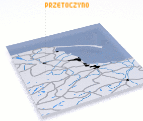 Places with similar names to Przetoczyno, Poland ::
// Przytoczno (PL)
Disclaimer :: Information on this page comes without warranty of any kind |
||
|
Where is Przetoczyno? Elevation and coordinates ::
Latitude (lat): 54°32'0"N Longitude (lon): 18°13'0"E
Elevation (approx.): 161m (map arrows pan, magnifying glasses zoom) |
||
|
Visiting Przetoczyno? Hotel/Accommodation ::
Book a hotel in Przetoczyno Travel Guide ::
Buy a travel guide for Poland rental cars ::
car rental offers GPS waypoint ::
download a GPX waypoint (PoI) of Przetoczyno for your GPS receiver
|
||