|
search place name
|
||
Przykop (Poland)Przykop is a town in Poland. An overview map of the region around Przykop is displayed below.
regional and 3d topo map of Przykop, Poland ::

Przykop airports ::
The nearest airport is KGD - Kaliningrad Khrabrovo, located 134.2 km north west of Przykop.
Other airports nearby include WAW - Warsaw Okecie (205.4 km south), Nearby towns ::
Kurówko (1.9km south) //
Marcinowa Wola (1.9km south) //
Miłki (1.1km east) //
Wierciejki (2.2km north west) //
Wyszowate (2.2km east) //
Kleszczewo (3.9km north) //
Paprotki (3.3km west) //
Konopki Wielkie (3.8km south east) //
Staświny (5.7km north) //
Ruda (5.7km north) //
Upałty (7.4km north) //
Buwełno (7.5km south) //
Cierzpięty (7.5km south) //
Miechy (4.7km north east) //
Ublik (6.5km south east) //
Zastrużne (8.1km south west) //
Lipowy Dwór (7.1km north east) //
[all distances 'as the bird flies' and approximate] 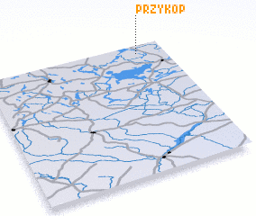
Disclaimer :: Information on this page comes without warranty of any kind |
||
|
Where is Przykop? Elevation and coordinates ::
Latitude (lat): 53°56'0"N Longitude (lon): 21°51'0"E
Elevation (approx.): 119m (map arrows pan, magnifying glasses zoom) |
||
|
Visiting Przykop? Hotel/Accommodation ::
Book a hotel in Przykop Travel Guide ::
Buy a travel guide for Poland rental cars ::
car rental offers GPS waypoint ::
download a GPX waypoint (PoI) of Przykop for your GPS receiver
|
||