|
search place name
|
||
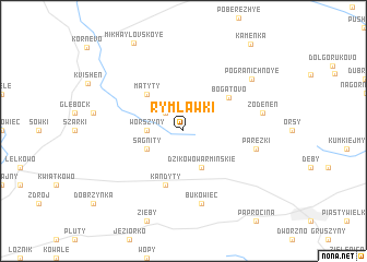
Rymławki (Poland)Rymławki is a town in Poland. An overview map of the region around Rymławki is displayed below.
regional and 3d topo map of Rymławki, Poland ::
Rymławki airports ::
The nearest airport is KGD - Kaliningrad Khrabrovo, located 59.8 km north of Rymławki.
Other airports nearby include GDN - Gdansk Lecha Walesy (124.6 km west), Nearby towns ::
Augamy (2.1km north west) //
Worszyny (2.2km west) //
Sągnity (2.8km south west) //
Dzikowo Warmińskie (3.9km south) //
Mątyty (4.3km north west) //
Bogatovo (4.4km north east) //
Kandyty (5.7km south) //
Pareżki (4.7km south east) //
Bukowiec (7.5km south) //
(( Zodenen )) (5.1km east) //
Pogranichnoye (6.7km north east) //
Kamenka (9.7km north east) //
[all distances 'as the bird flies' and approximate]  Places with similar names to Rymławki, Poland ::
// Rrumbullak (AL)
// Remlik (US)
// Rammalaka (LK)
// Rombe Lako (SD)
// Rumaylik (SD)
// Rumualogu (NG)
// Romelʼki (BY)
Disclaimer :: Information on this page comes without warranty of any kind |
||
|
Where is Rymławki? Elevation and coordinates ::
Latitude (lat): 54°22'0"N Longitude (lon): 20°23'0"E
Elevation (approx.): 155m (map arrows pan, magnifying glasses zoom) |
||
|
Visiting Rymławki? Hotel/Accommodation ::
Book a hotel in Rymławki Travel Guide ::
Buy a travel guide for Poland rental cars ::
car rental offers GPS waypoint ::
download a GPX waypoint (PoI) of Rymławki for your GPS receiver
|
||