|
search place name
|
||
Skwarne (Poland)Skwarne is a town in Poland. An overview map of the region around Skwarne is displayed below.
regional and 3d topo map of Skwarne, Poland ::

Skwarne airports ::
The nearest airport is WAW - Warsaw Okecie, located 54.8 km west of Skwarne.
Nearby towns ::
Sokolnik (2.3km east) //
Rudniki (3.7km north) //
Kuflew (3.9km south) //
Piaseczno (3.9km south) //
Kruki (3.9km north) //
Cegłów (2.9km north west) //
Mrozy (4.3km north east) //
Pełczanka (4.3km north west) //
Ryczołek (5.6km north) //
Wola Stanisławowska (5.7km south) //
Dąbrowa (3.9km south east) //
Skupie (5.7km south) //
Cisie (3.9km north west) //
Wola Rafałowska (3.9km north east) //
Posiadały (5.0km south west) //
Kiczki (6.0km south) //
Rososz (4.9km west) //
Mienia (4.9km west) //
Stawek (6.5km south east) //
Waliska (7.8km south) //
Mała Wieś (5.9km south east) //
Jędrzejów (7.8km north) //
Wężyczyn (8.2km south east) //
Kołacz (7.2km south east) //
Szymony (7.2km north east) //
Siodło (7.2km south west) //
Olszewice (8.2km north east) //
Huta Żakowska (8.7km south west) //
Antonin (8.7km north west) //
[all distances 'as the bird flies' and approximate] 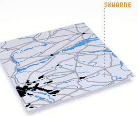 Places with similar names to Skwarne, Poland :: Disclaimer :: Information on this page comes without warranty of any kind |
||
|
Where is Skwarne? Elevation and coordinates ::
Latitude (lat): 52°8'0"N Longitude (lon): 21°46'0"E
Elevation (approx.): 174m (map arrows pan, magnifying glasses zoom) |
||
|
Visiting Skwarne? Hotel/Accommodation ::
Book a hotel in Skwarne Travel Guide ::
Buy a travel guide for Poland rental cars ::
car rental offers GPS waypoint ::
download a GPX waypoint (PoI) of Skwarne for your GPS receiver
|
||