|
search place name
|
||
Słomkowo (Poland)Słomkowo is a town in Poland. An overview map of the region around Słomkowo is displayed below.
regional and 3d topo map of Słomkowo, Poland ::

Słomkowo airports ::
The nearest airport is POZ - Poznan Lawica, located 137.0 km west of Słomkowo.
Other airports nearby include GDN - Gdansk Lecha Walesy (172.8 km north), OSP - Slupsk Redzikowo (212.3 km north west), WRO - Wroclaw Strachowice (230.6 km south west), Nearby towns ::
Brzeźno Towarzystwo (1.9km south) //
Brzeźno (1.1km east) //
Ośno (2.2km north west) //
Konradowo (2.2km north east) //
Ostrowąs (2.2km west) //
Młynek (3.7km south) //
Łazieniec (3.7km north) //
Stawki (3.7km north) //
Kamieniec (3.9km south) //
Chromowola (2.9km south west) //
Zalesie (2.9km north east) //
Odolion (3.9km north) //
Aleksandrów Kujawski (4.3km north west) //
Kuczek (4.3km north east) //
Turzno (3.4km east) //
Koneck (5.7km south) //
Ossówka (3.8km south east) //
Wygoda (5.7km north) //
Spoczynek (5.7km south) //
Stara Wieś (3.8km north west) //
Plebanka (3.8km north west) //
Rudunki (5.0km north west) //
Opalonka (7.4km south) //
Kolonia Przybranowo (4.5km west) //
Zazdromin (4.8km west) //
Kajetanowo (7.5km south) //
Wołuszewo (7.5km north) //
Święte (6.5km south east) //
Rybno (6.5km south west) //
[all distances 'as the bird flies' and approximate] 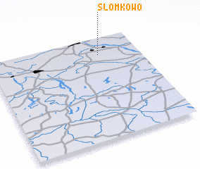
Disclaimer :: Information on this page comes without warranty of any kind |
||
|
Where is Słomkowo? Elevation and coordinates ::
Latitude (lat): 52°50'0"N Longitude (lon): 18°44'0"E
Elevation (approx.): 86m (map arrows pan, magnifying glasses zoom) |
||
|
Visiting Słomkowo? Hotel/Accommodation ::
Book a hotel in Słomkowo Travel Guide ::
Buy a travel guide for Poland rental cars ::
car rental offers GPS waypoint ::
download a GPX waypoint (PoI) of Słomkowo for your GPS receiver
|
||