|
search place name
|
||
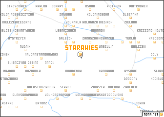
Stara Wieś (Poland)Stara Wieś is a town in Poland. An overview map of the region around Stara Wieś is displayed below.
regional and 3d topo map of Stara Wieś, Poland ::
Stara Wieś airports ::
The nearest airport is RZE - Rzeszow Jasionka, located 101.2 km south west of Stara Wieś.
Other airports nearby include LWO - Lvov Lviv Intl (160.5 km south east), WAW - Warsaw Okecie (174.9 km north west), Nearby towns ::
Zaraszów (3.9km north) //
Wola Gałęzowska (3.9km north) //
Nikodemów (3.9km south) //
Gałęzów (4.4km north west) //
Urszulin (4.0km north east) //
Kosarzew (5.1km north east) //
Kosarzew Dolny (5.1km north east) //
Romanów (6.0km north east) //
Tarnawka (5.1km south east) //
Leśniczówka (6.0km north west) //
Wola Duża (7.5km north) //
Wola Mała (7.5km north) //
Annów (5.0km west) //
Olszowiec (7.8km north) //
Zakrzew (7.8km south) //
Bychawa (7.8km north) //
Grodzany (7.8km north) //
Stawce (7.8km south) //
Biesiadki (8.2km north east) //
Lewandowszczyzna (8.8km north east) //
Boćków (8.8km south east) //
[all distances 'as the bird flies' and approximate]  Places with similar names to Stara Wieś, Poland ::
// Cedrowice (PL)
// Cedrowice (PL)
// Stara Wieś (PL)
// Stara Wieś (PL)
// Stara Wieś (PL)
// Stara Wieś (PL)
// Stara Wieś (PL)
// Stara Wieś (PL)
// Stara Wieś (PL)
// Stara Wieś (PL)
Disclaimer :: Information on this page comes without warranty of any kind |
||
|
Where is Stara Wieś? Elevation and coordinates ::
Latitude (lat): 50°57'0"N Longitude (lon): 22°34'0"E
Elevation (approx.): 255m (map arrows pan, magnifying glasses zoom) |
||
|
Visiting Stara Wieś? Hotel/Accommodation ::
Book a hotel in Stara Wieś Travel Guide ::
Buy a travel guide for Poland rental cars ::
car rental offers GPS waypoint ::
download a GPX waypoint (PoI) of Stara Wieś for your GPS receiver
|
||