|
search place name
|
||
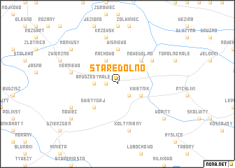
Stare Dolno (Poland)Stare Dolno is a town in Poland. An overview map of the region around Stare Dolno is displayed below.
regional and 3d topo map of Stare Dolno, Poland ::
Stare Dolno airports ::
The nearest airport is GDN - Gdansk Lecha Walesy, located 75.8 km north west of Stare Dolno.
Other airports nearby include KGD - Kaliningrad Khrabrovo (124.4 km north east), WAW - Warsaw Okecie (228.5 km south east), Nearby towns ::
Brudzędy Wielkie (1.1km west) //
Kwietniewo (2.1km south east) //
Brudzędy Małe (2.2km west) //
Rachowo (3.9km north) //
Kwietnik (2.9km south east) //
Święty Gaj (4.3km south west) //
Nowe Dolno (4.3km north east) //
Dzierzgonka (5.6km north) //
Wiśniewo (5.6km north) //
Stankowo (4.9km north east) //
Kępniewo (4.7km north west) //
Krzewsk (7.5km north) //
Balewo (7.5km north) //
Kołtyniany (7.5km south) //
Bągart (5.7km south west) //
Nowiec (7.1km south west) //
Markusy (7.1km north west) //
Wopity (7.1km south east) //
[all distances 'as the bird flies' and approximate] 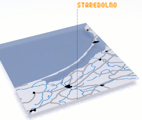 Places with similar names to Stare Dolno, Poland ::
Disclaimer :: Information on this page comes without warranty of any kind |
||
|
Where is Stare Dolno? Elevation and coordinates ::
Latitude (lat): 54°0'0"N Longitude (lon): 19°26'0"E
Elevation (approx.): 17m (map arrows pan, magnifying glasses zoom) |
||
|
Visiting Stare Dolno? Hotel/Accommodation ::
Book a hotel in Stare Dolno Travel Guide ::
Buy a travel guide for Poland rental cars ::
car rental offers GPS waypoint ::
download a GPX waypoint (PoI) of Stare Dolno for your GPS receiver
|
||