|
search place name
|
||
Stasiówka (Poland)Stasiówka is a town in Poland. An overview map of the region around Stasiówka is displayed below.
regional and 3d topo map of Stasiówka, Poland ::

Stasiówka airports ::
The nearest airport is RZE - Rzeszow Jasionka, located 40.9 km east of Stasiówka.
Other airports nearby include KRK - Krakow Balice (120.7 km west), TAT - Poprad Tatry (137.4 km south west), KSC - Kosice (151.4 km south), Nearby towns ::
Stobierna (2.2km north east) //
Zawada (3.9km north) //
Nagawczyna (3.9km north) //
Bobrek (3.0km north east) //
Braciejowa (4.4km south west) //
Łupiny (3.6km east) //
Wytrząska (3.6km west) //
Głobikowa (5.7km south) //
Gawrzyłowa (5.1km north west) //
Dębica (5.1km north west) //
Niedźwiada (5.1km south east) //
Kozłów (7.4km north) //
Pustynia (7.5km north) //
Grudna Górna (7.5km south) //
Sepnica (6.6km north east) //
Mała (6.6km south east) //
Kędzierz (7.8km north) //
Paszczyna (8.2km north east) //
Lubzina (7.3km north east) //
Kolonia Żyraków (8.2km north west) //
Gębiczyn (7.3km south west) //
Żyraków (8.8km north west) //
[all distances 'as the bird flies' and approximate] 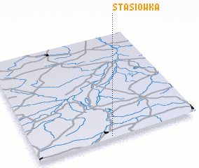 Places with similar names to Stasiówka, Poland ::
// Stasiówka (PL)
// Satsheka (CD)
// Satachic (MX)
// Sāda Chak (PK)
// Saetchak (KR)
// Sui Tchay (2) (VN)
// Sidi Chikh (DZ)
// Sodyshka (RU)
Disclaimer :: Information on this page comes without warranty of any kind |
||
|
Where is Stasiówka? Elevation and coordinates ::
Latitude (lat): 50°1'0"N Longitude (lon): 21°28'0"E
Elevation (approx.): 334m (map arrows pan, magnifying glasses zoom) |
||
|
Visiting Stasiówka? Hotel/Accommodation ::
Book a hotel in Stasiówka Travel Guide ::
Buy a travel guide for Poland rental cars ::
car rental offers GPS waypoint ::
download a GPX waypoint (PoI) of Stasiówka for your GPS receiver
|
||