|
search place name
|
||
Strzelczew (Poland)Strzelczew is a town in Poland. An overview map of the region around Strzelczew is displayed below.
regional and 3d topo map of Strzelczew, Poland ::

Strzelczew airports ::
The nearest airport is WAW - Warsaw Okecie, located 66.3 km east of Strzelczew.
Other airports nearby include KTW - Katowice Pyrzowice (195.4 km south), Nearby towns ::
Zabostów Mały (1.9km south) //
Płaskocin (1.9km north) //
Popów (2.2km south west) //
Janowice (2.9km south east) //
Zabostów Duży (2.9km south east) //
Zabostów (2.9km south east) //
Sromów (2.9km north east) //
Łaguszew (2.9km north west) //
Boczki (3.9km north) //
Mysłaków (4.3km south east) //
Arkadia (5.6km south) //
Zielkowiec (5.7km south) //
Błędów (6.0km north) //
Gągolin (5.0km north east) //
Sierżniki (5.0km north west) //
Kompina (4.6km east) //
Bobrowniki (7.5km south) //
Placencja (7.5km south) //
Wygoda (7.5km south) //
Małszyce (4.9km west) //
Łowicz (4.9km west) //
Bednary (4.9km east) //
Goleńsko (4.9km west) //
Wicie (7.5km north) //
Gągolin Zachodni (6.5km north east) //
Gągolin Południowy (5.9km north east) //
Julianów (7.2km south east) //
Gągolin Północny (7.2km north east) //
Chąśno (8.7km north west) //
[all distances 'as the bird flies' and approximate] 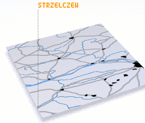 Places with similar names to Strzelczew, Poland :: Disclaimer :: Information on this page comes without warranty of any kind |
||
|
Where is Strzelczew? Elevation and coordinates ::
Latitude (lat): 52°8'0"N Longitude (lon): 20°0'0"E
Elevation (approx.): 86m (map arrows pan, magnifying glasses zoom) |
||
|
Visiting Strzelczew? Hotel/Accommodation ::
Book a hotel in Strzelczew Travel Guide ::
Buy a travel guide for Poland rental cars ::
car rental offers GPS waypoint ::
download a GPX waypoint (PoI) of Strzelczew for your GPS receiver
|
||