|
search place name
|
||
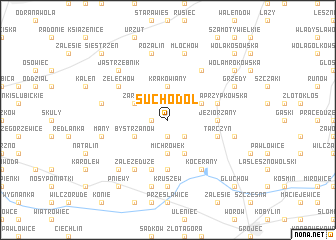
Suchodół (Poland)Suchodół is a town in Poland. An overview map of the region around Suchodół is displayed below.
regional and 3d topo map of Suchodół, Poland ::
Suchodół airports ::
The nearest airport is WAW - Warsaw Okecie, located 23.9 km north east of Suchodół.
Other airports nearby include KTW - Katowice Pyrzowice (205.8 km south west), KRK - Krakow Balice (223.3 km south), RZE - Rzeszow Jasionka (225.7 km south east), Nearby towns ::
Kolonia Świętochów (1.9km south) //
Jeżewice (1.1km west) //
Świętochów (2.2km south east) //
Michrówek (3.7km south) //
Krakowiany (3.7km north) //
Bystrzanów (2.9km south west) //
Michrów (3.9km south) //
Ojrzanów (2.9km north west) //
Zaręby (2.9km north west) //
Przypki (2.9km north east) //
Kruszewek (5.6km south) //
Jeziorzany (3.4km east) //
Wola Pniewska (5.7km south) //
Tarczyn (3.9km south east) //
Wola Przypkowska (3.9km north east) //
Załęże (6.0km south) //
Załęże Duże (6.0km south) //
Kocerany (6.0km south) //
Żelechów (5.0km north west) //
Parole (6.0km north) //
Kruszew (7.4km south) //
Many (4.9km west) //
Jurki (7.5km south) //
Julianów (4.9km west) //
Pieńki Zarębskie (4.9km west) //
Rozalin (7.5km north) //
Komorniki (4.9km east) //
Rembertów (4.9km east) //
Młochów (7.5km north) //
[all distances 'as the bird flies' and approximate]  Places with similar names to Suchodół, Poland ::
Disclaimer :: Information on this page comes without warranty of any kind |
||
|
Where is Suchodół? Elevation and coordinates ::
Latitude (lat): 51°59'0"N Longitude (lon): 20°47'0"E
Elevation (approx.): 163m (map arrows pan, magnifying glasses zoom) |
||
|
Visiting Suchodół? Hotel/Accommodation ::
Book a hotel in Suchodół Travel Guide ::
Buy a travel guide for Poland rental cars ::
car rental offers GPS waypoint ::
download a GPX waypoint (PoI) of Suchodół for your GPS receiver
|
||