|
search place name
|
||
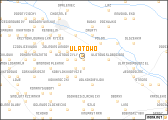
Ulatowo (Poland)Ulatowo is a town in Poland. An overview map of the region around Ulatowo is displayed below.
regional and 3d topo map of Ulatowo, Poland ::
Ulatowo airports ::
The nearest airport is WAW - Warsaw Okecie, located 113.2 km south of Ulatowo.
Other airports nearby include KGD - Kaliningrad Khrabrovo (191.4 km north), Nearby towns ::
Ulatowo Barzuchy (0.0km north) //
Ulatowo Czerniaki (1.9km south) //
Ulatowo Niwki (1.1km west) //
Ulatowo Adamy (2.2km south west) //
Ulatowo Żyły (2.2km west) //
Ulatowo Zalesie (2.9km north west) //
Kobylaki Konopki (3.9km south) //
Kobylaki Korysze (4.3km south west) //
Połoń (4.3km north east) //
Ulatowo Słabogóra (3.3km east) //
Brzeski Kołaki (5.7km north) //
Przysowy (5.7km north) //
Zagaty (5.7km north) //
Zalesie Świniarskie (3.8km north west) //
Kobylaki Czarzaste (5.7km south) //
Wólka Kobylaki (5.7km south) //
Rycice (5.0km north west) //
Bronowo Plewnik (4.8km south west) //
Świniary (4.8km north west) //
Budki (7.5km north) //
Lipowiec (6.5km north west) //
Kaki Mroczki (6.5km south west) //
Małowidz (5.8km north east) //
Rembielin (7.1km north west) //
Rachujka (8.1km north east) //
Romany Fuszki (8.6km south west) //
[all distances 'as the bird flies' and approximate] 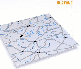
Disclaimer :: Information on this page comes without warranty of any kind |
||
|
Where is Ulatowo? Elevation and coordinates ::
Latitude (lat): 53°11'0"N Longitude (lon): 20°57'0"E
Elevation (approx.): 142m (map arrows pan, magnifying glasses zoom) |
||
|
Visiting Ulatowo? Hotel/Accommodation ::
Book a hotel in Ulatowo Travel Guide ::
Buy a travel guide for Poland rental cars ::
car rental offers GPS waypoint ::
download a GPX waypoint (PoI) of Ulatowo for your GPS receiver
|
||