|
search place name
|
||
Wola Brwileńska (Poland)Wola Brwileńska is a town in Poland. An overview map of the region around Wola Brwileńska is displayed below.
regional and 3d topo map of Wola Brwileńska, Poland ::

Wola Brwileńska airports ::
The nearest airport is WAW - Warsaw Okecie, located 107.4 km south east of Wola Brwileńska.
Other airports nearby include GDN - Gdansk Lecha Walesy (213.6 km north), Nearby towns ::
Duninów Stary (1.1km west) //
Biskupice (1.9km north) //
Murzynowo (2.9km north west) //
Srodoń (2.9km south west) //
Emilin (3.9km south) //
Brwilno Nowe (2.9km south east) //
Ulaszewo (4.3km north east) //
Soczewka (4.3km south east) //
Trzcianno (3.4km west) //
Mokre Niemieckie (5.6km south) //
Nowy Duninów (3.9km north west) //
Siecień (5.7km north) //
Mokre Polskie (5.7km south) //
Brwilno Dolne (3.9km south east) //
Mozdzierz (3.9km south east) //
Lasotki (5.7km north) //
Klusek Biały (6.0km south) //
Robertowo Żerniki (7.4km north) //
Antoninów (7.4km south) //
Brwilno Góne (4.5km east) //
Brwilno (4.5km east) //
Żerniki (7.5km north) //
Kolonia Srodoń (4.9km west) //
Stanożęta (6.5km south east) //
Sędeń Jeziorko (6.5km south east) //
Kobierniki (6.5km north east) //
Mańkowo (5.8km north east) //
Wyszyna (5.8km north east) //
Sędeń Mały (7.7km south) //
[all distances 'as the bird flies' and approximate] 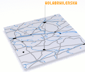 Places with similar names to Wola Brwileńska, Poland :: Disclaimer :: Information on this page comes without warranty of any kind |
||
|
Where is Wola Brwileńska? Elevation and coordinates ::
Latitude (lat): 52°34'0"N Longitude (lon): 19°32'0"E
Elevation (approx.): 54m (map arrows pan, magnifying glasses zoom) |
||
|
Visiting Wola Brwileńska? Hotel/Accommodation ::
Book a hotel in Wola Brwileńska Travel Guide ::
Buy a travel guide for Poland rental cars ::
car rental offers GPS waypoint ::
download a GPX waypoint (PoI) of Wola Brwileńska for your GPS receiver
|
||