|
search place name
|
||
Wołyńce (Poland)Wołyńce is a town in Poland. An overview map of the region around Wołyńce is displayed below.
regional and 3d topo map of Wołyńce, Poland ::

Wołyńce airports ::
The nearest airport is WAW - Warsaw Okecie, located 85.7 km west of Wołyńce.
Nearby towns ::
Lipniak (1.9km south) //
Myrcha (2.3km east) //
Teodorów (2.3km west) //
Stok Wiśniewski (2.9km south east) //
Gołąbek (3.9km south) //
Żelków (4.3km north west) //
Iganie Stare (5.6km north) //
Iganie (5.6km north) //
Przywory (5.7km south) //
Przywory Duże (5.7km south) //
Dąbrówka Wyłazy (5.0km north west) //
Iganie Nowe (6.0km north) //
Przywory Małe (6.0km south) //
Dąbrówka Ług (4.6km west) //
Grabianów (4.9km east) //
Opole Stare (6.5km north west) //
Drupia (6.5km south west) //
Sabinka (7.8km north) //
Opole Nowe (7.8km north) //
Wiśniew (5.9km south east) //
Dąbrówka Niwka (5.9km north west) //
Jastrzębie (7.8km south) //
Jastrzębie Lupiny (7.8km south) //
Domanice (7.8km south) //
Kaczory (8.2km south east) //
Jastrzębie Tworki (8.7km south east) //
[all distances 'as the bird flies' and approximate] 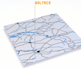 Places with similar names to Wołyńce, Poland ::
Disclaimer :: Information on this page comes without warranty of any kind |
||
|
Where is Wołyńce? Elevation and coordinates ::
Latitude (lat): 52°7'0"N Longitude (lon): 22°13'0"E
Elevation (approx.): 176m (map arrows pan, magnifying glasses zoom) |
||
|
Visiting Wołyńce? Hotel/Accommodation ::
Book a hotel in Wołyńce Travel Guide ::
Buy a travel guide for Poland rental cars ::
car rental offers GPS waypoint ::
download a GPX waypoint (PoI) of Wołyńce for your GPS receiver
|
||