|
search place name
|
||
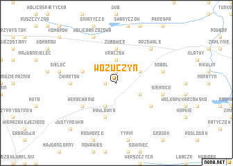
Wożuczyn (Poland)Wożuczyn is a town in Poland. An overview map of the region around Wożuczyn is displayed below.
regional and 3d topo map of Wożuczyn, Poland ::
Wożuczyn airports ::
The nearest airport is LWO - Lvov Lviv Intl, located 88.4 km south of Wożuczyn.
Other airports nearby include RZE - Rzeszow Jasionka (121.3 km south west), Nearby towns ::
Kozia Wola (1.9km north) //
Zwiartówek (1.2km west) //
Kraczew (3.7km north) //
Czartowczyk (3.0km north east) //
Michałów (3.0km south east) //
Józefówka (3.9km south) //
Rachanie (3.9km south) //
Zubowice (5.6km north) //
Siemierz (4.0km north west) //
Pawłówka (5.7km south) //
Grodysławice (5.1km south east) //
Werachanie (5.1km south west) //
Zwiartów (4.7km west) //
Soból (5.1km east) //
Siemnice (5.1km east) //
Przewale (6.6km north east) //
Wolica Brzozowa (7.8km north) //
Justynówka (8.8km south west) //
[all distances 'as the bird flies' and approximate] 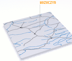 Places with similar names to Wożuczyn, Poland ::
// Wężyczyn (PL)
Disclaimer :: Information on this page comes without warranty of any kind |
||
|
Where is Wożuczyn? Elevation and coordinates ::
Latitude (lat): 50°34'0"N Longitude (lon): 23°34'0"E
Elevation (approx.): 239m (map arrows pan, magnifying glasses zoom) |
||
|
Visiting Wożuczyn? Hotel/Accommodation ::
Book a hotel in Wożuczyn Travel Guide ::
Buy a travel guide for Poland rental cars ::
car rental offers GPS waypoint ::
download a GPX waypoint (PoI) of Wożuczyn for your GPS receiver
|
||