|
search place name
|
||
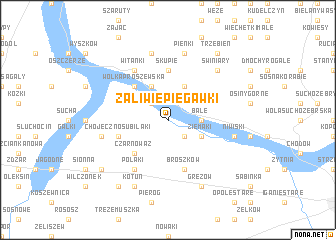
Zaliwie Piegawki (Poland)Zaliwie Piegawki is a town in Poland. An overview map of the region around Zaliwie Piegawki is displayed below.
regional and 3d topo map of Zaliwie Piegawki, Poland ::
Zaliwie Piegawki airports ::
The nearest airport is WAW - Warsaw Okecie, located 78.0 km west of Zaliwie Piegawki.
Nearby towns ::
Żuków (2.2km south east) //
Zaliwie Szpinki (2.2km north west) //
Bale (2.3km east) //
Ziemaki (2.9km south east) //
Mokobody (3.9km north) //
Męczyn (3.9km north) //
Czarnoważ (4.3km south west) //
Wólka Proszewska (4.3km north west) //
Skupie (5.6km north) //
Broszków (5.7km south) //
Chojeczno Subilaki (3.9km south west) //
Witanki (6.0km north) //
Polaki (6.0km south) //
Pieńki (7.5km north) //
Księżopole Budki (7.5km north) //
Księżopole Smolaki (7.5km north) //
Niwiski (4.9km east) //
Chojeczno Cesarskie (4.9km west) //
Chojeczno (4.9km west) //
Świniary (6.5km north east) //
Gręzów (7.8km south) //
Kotuń (7.8km south) //
Trzebień (8.2km north east) //
Józefin (8.2km south west) //
Mingosy (7.2km south west) //
[all distances 'as the bird flies' and approximate]  Places with similar names to Zaliwie Piegawki, Poland :: Disclaimer :: Information on this page comes without warranty of any kind |
||
|
Where is Zaliwie Piegawki? Elevation and coordinates ::
Latitude (lat): 52°15'0"N Longitude (lon): 22°6'0"E
Elevation (approx.): 131m (map arrows pan, magnifying glasses zoom) |
||
|
Visiting Zaliwie Piegawki? Hotel/Accommodation ::
Book a hotel in Zaliwie Piegawki Travel Guide ::
Buy a travel guide for Poland rental cars ::
car rental offers GPS waypoint ::
download a GPX waypoint (PoI) of Zaliwie Piegawki for your GPS receiver
|
||