|
search place name
|
||
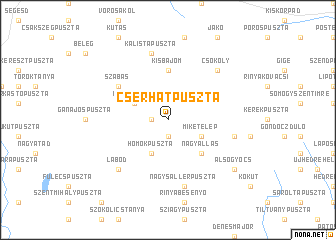
Cserhátpuszta (Somogy, Hungary)Cserhátpuszta is a town in the Somogy region of Hungary. An overview map of the region around Cserhátpuszta is displayed below.
regional and 3d topo map of Cserhátpuszta, Hungary ::
Cserhátpuszta airports ::
The nearest airport is ZAG - Zagreb, located 124.4 km south west of Cserhátpuszta.
Other airports nearby include OSI - Osijek (134.2 km south east), MBX - Maribor (141.9 km west), BUD - Budapest Ferihegy (188.0 km north east), BTS - Bratislava M R Stefanik (214.6 km north), Nearby towns ::
Vadaspuszta (1.3km west) //
Petesmalom (1.9km south) //
Miketelep (3.2km south east) //
Felsőgyócs (3.2km south east) //
Nagykorpád (3.2km north west) //
Mike (3.2km south east) //
Móriczpuszta (3.2km north west) //
Homokpuszta (3.9km south) //
Nagyállás (4.5km south east) //
Kisbajom (5.6km north) //
Szabás (5.3km north west) //
Nagysallérpuszta (7.5km south) //
Kálistapuszta (7.5km north) //
Mikepuszta (5.5km east) //
Lábod (6.8km south west) //
Csököly (6.8km north east) //
Alsógyócs (7.6km south east) //
[all distances 'as the bird flies' and approximate] 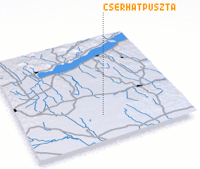 Places with similar names to Cserhátpuszta, Hungary ::
Disclaimer :: Information on this page comes without warranty of any kind |
||
|
Where is Cserhátpuszta? Elevation and coordinates ::
Latitude (lat): 46°15'0"N Longitude (lon): 17°30'0"E
Elevation (approx.): 153m (map arrows pan, magnifying glasses zoom) |
||
|
Visiting Cserhátpuszta? Hotel/Accommodation ::
Book a hotel in Cserhátpuszta Travel Guide ::
Buy a travel guide for Hungary rental cars ::
car rental offers GPS waypoint ::
download a GPX waypoint (PoI) of Cserhátpuszta for your GPS receiver
|
||