|
search place name
|
||
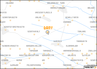
Dány (Pest, Hungary)Dány is a town in the Pest region of Hungary. An overview map of the region around Dány is displayed below.
regional and 3d topo map of Dány, Hungary ::
Dány airports ::
The nearest airport is BUD - Budapest Ferihegy, located 23.9 km west of Dány.
Other airports nearby include SLD - Sliac (128.5 km north), PZY - Piestany (177.9 km north west), KSC - Kosice (179.2 km north east), TAT - Poprad Tatry (180.6 km north), Nearby towns ::
Kóka (4.5km south east) //
Alsóhegy (4.5km south east) //
Újszőlő (4.5km south east) //
Felsőhegy (4.5km south east) //
Szentkirály (3.8km west) //
Valkó (6.1km north west) //
Tápiósüly (7.4km south) //
Vácszentlászló (7.5km north) //
Buzbokor (7.5km south) //
Cirokvölgy (7.5km south) //
Sándorszállás (6.7km south west) //
Jakabszállás (6.7km south west) //
Zsámbok (6.2km north east) //
Tápiószecső (8.3km south east) //
Tó Útja (8.3km south east) //
Tápiósáp (8.3km south west) //
Kisperjés (8.3km south east) //
Kistelek (7.5km south west) //
Nagyoszlár (8.9km south west) //
[all distances 'as the bird flies' and approximate] 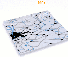 Places with similar names to Dány, Hungary ::
Disclaimer :: Information on this page comes without warranty of any kind |
||
|
Where is Dány? Elevation and coordinates ::
Latitude (lat): 47°31'0"N Longitude (lon): 19°33'0"E
Elevation (approx.): 157m (map arrows pan, magnifying glasses zoom) |
||
|
Visiting Dány? Hotel/Accommodation ::
Book a hotel in Dány Travel Guide ::
Buy a travel guide for Hungary rental cars ::
car rental offers GPS waypoint ::
download a GPX waypoint (PoI) of Dány for your GPS receiver
|
||