|
search place name
|
||
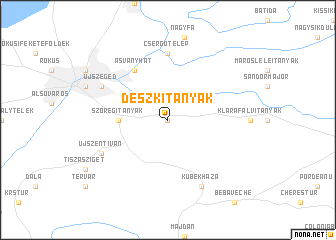
Deszki Tanyák (Csongrád, Hungary)Deszki Tanyák is a town in the Csongrád region of Hungary. An overview map of the region around Deszki Tanyák is displayed below.
regional and 3d topo map of Deszki Tanyák, Hungary ::
Deszki Tanyák airports ::
The nearest airport is ARW - Arad, located 78.2 km east of Deszki Tanyák.
Other airports nearby include TSR - Timisoara Traian Vuia (95.6 km south east), OSI - Osijek (139.8 km south west), OMR - Oradea (155.2 km north east), BUD - Budapest Ferihegy (155.4 km north west), Nearby towns ::
Deszk (NaNkm north) //
Szőregitanyák (3.8km west) //
Ásványhát (6.1km north west) //
Csergőtelep (7.4km north) //
Kübekháza (7.8km south) //
Újszeged (6.3km north west) //
Újszentiván (6.3km south west) //
[all distances 'as the bird flies' and approximate] 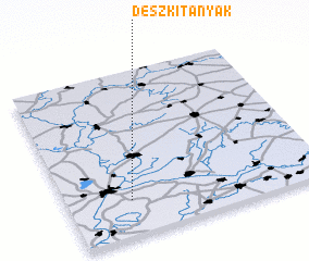 Places with similar names to Deszki Tanyák, Hungary :: Disclaimer :: Information on this page comes without warranty of any kind |
||
|
Where is Deszki Tanyák? Elevation and coordinates ::
Latitude (lat): 46°13'0"N Longitude (lon): 20°15'0"E
Elevation (approx.): 78m (map arrows pan, magnifying glasses zoom) |
||
|
Visiting Deszki Tanyák? Hotel/Accommodation ::
Book a hotel in Deszki Tanyák Travel Guide ::
Buy a travel guide for Hungary rental cars ::
car rental offers GPS waypoint ::
download a GPX waypoint (PoI) of Deszki Tanyák for your GPS receiver
|
||