|
search place name
|
||
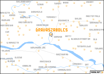
Drávaszabolcs (Baranya, Hungary)Drávaszabolcs is a town in the Baranya region of Hungary. An overview map of the region around Drávaszabolcs is displayed below.
regional and 3d topo map of Drávaszabolcs, Hungary ::
Drávaszabolcs airports ::
The nearest airport is OSI - Osijek, located 60.3 km south east of Drávaszabolcs.
Other airports nearby include BUD - Budapest Ferihegy (198.2 km north east), SJJ - Sarajevo (220.4 km south), Nearby towns ::
Gordisa (2.0km south east) //
Ipacsfa (3.3km north) //
Drávapalkonya (2.5km west) //
Lajosháza (3.4km north east) //
Kovácshida (3.9km north west) //
Drávacsehi (3.5km west) //
Harkány (5.1km north east) //
Terehegy (6.1km north) //
Matty (4.3km east) //
Drávaszerdahely (5.0km north west) //
Lulupuszta (5.3km north east) //
Miskaháza (5.8km north east) //
Márfa (6.4km north) //
Donji Miholjac (6.1km south west) //
Cseripuszta (5.7km east) //
Aranyos (6.4km north east) //
Sveti Ðurađ (7.9km south) //
Drávacsepely (6.2km north west) //
Keselyősfapuszta (6.7km south east) //
Gyűrűspuszta (7.2km south east) //
Diósviszló (8.8km north west) //
Csukma (7.8km north east) //
Podgajci Podravski (9.7km south east) //
[all distances 'as the bird flies' and approximate]  Places with similar names to Drávaszabolcs, Hungary :: Disclaimer :: Information on this page comes without warranty of any kind |
||
|
Where is Drávaszabolcs? Elevation and coordinates ::
Latitude (lat): 45°48'21"N Longitude (lon): 18°12'41"E
Elevation (approx.): 90m (map arrows pan, magnifying glasses zoom) |
||
|
Visiting Drávaszabolcs? Hotel/Accommodation ::
Book a hotel in Drávaszabolcs Travel Guide ::
Buy a travel guide for Hungary rental cars ::
car rental offers GPS waypoint ::
download a GPX waypoint (PoI) of Drávaszabolcs for your GPS receiver
|
||