|
search place name
|
||
Hegyszentmárton (Baranya, Hungary)Hegyszentmárton is a town in the Baranya region of Hungary. An overview map of the region around Hegyszentmárton is displayed below.
regional and 3d topo map of Hegyszentmárton, Hungary ::

Hegyszentmárton airports ::
The nearest airport is OSI - Osijek, located 74.5 km south east of Hegyszentmárton.
Other airports nearby include BUD - Budapest Ferihegy (192.3 km north east), Nearby towns ::
Alsópalajpuszta (2.3km south) //
Tengeri (2.5km north) //
Siklósbodony (2.4km east) //
Tüskés (3.6km south east) //
Kórós (4.1km south) //
Babarcszőlős (3.6km east) //
Rádfapuszta (5.2km north) //
Almáspuszta (4.3km south west) //
Bogádmindszent (3.8km west) //
Baksa (5.5km north) //
Kisdér (5.0km north east) //
Rádfalva (5.6km south east) //
Adorjás (6.3km south) //
Téseny (5.9km north west) //
Szekerekpuszta (5.7km south west) //
Drávapiski (7.2km south) //
Ócsárd (5.9km north east) //
Nagysárostó (7.3km south east) //
Ereszvény (7.8km south) //
Sámod (6.8km south west) //
Ózdfalu (6.0km north west) //
Szalántatelep (5.7km west) //
Monyoróska (8.1km south) //
Vaskapupuszta (5.9km east) //
Páprádpuszta (6.1km west) //
Diósviszló (6.4km south east) //
Görcsöny (8.1km north east) //
Kémes (8.9km south) //
Velény (9.0km north) //
[all distances 'as the bird flies' and approximate] 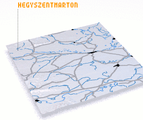 Places with similar names to Hegyszentmárton, Hungary :: Disclaimer :: Information on this page comes without warranty of any kind |
||
|
Where is Hegyszentmárton? Elevation and coordinates ::
Latitude (lat): 45°54'14"N Longitude (lon): 18°5'24"E
Elevation (approx.): 105m (map arrows pan, magnifying glasses zoom) |
||
|
Visiting Hegyszentmárton? Hotel/Accommodation ::
Book a hotel in Hegyszentmárton Travel Guide ::
Buy a travel guide for Hungary rental cars ::
car rental offers GPS waypoint ::
download a GPX waypoint (PoI) of Hegyszentmárton for your GPS receiver
|
||