|
search place name
|
||
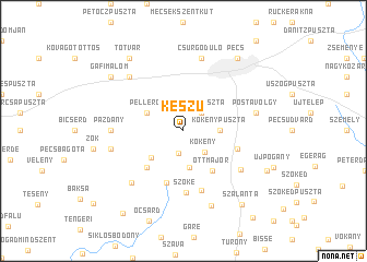
Keszü (Baranya, Hungary)Keszü is a town in the Baranya region of Hungary. An overview map of the region around Keszü is displayed below.
regional and 3d topo map of Keszü, Hungary ::
Keszü airports ::
The nearest airport is OSI - Osijek, located 78.6 km south east of Keszü.
Other airports nearby include BUD - Budapest Ferihegy (177.9 km north east), Nearby towns ::
Gyód (2.3km south) //
Péterpuszta (2.3km north east) //
Kökény (2.7km south east) //
Kökénypuszta (2.6km east) //
Szentpálpuszta (3.7km south) //
Pellérd (3.2km north west) //
Keresztespuszta (3.6km south west) //
Ottmajor (4.6km south east) //
Keménygadány (4.5km south west) //
Regenye (5.4km south) //
Csontoscsárda (4.3km south east) //
Szőke (6.3km south) //
Szilvás (6.2km south) //
Nándorliget (5.7km south east) //
Pázdány (5.1km west) //
Görcsöny (6.4km south west) //
Csoronika (7.5km north) //
Czupytelep (7.5km north) //
Felsőmakár (7.5km north) //
Kisdeindol (7.5km north) //
Kismélyvölgy (7.5km north) //
Középdeindol (7.5km north) //
Nagydeindol (7.5km north) //
Aranyhegy (7.5km north) //
Alsóhegy (7.5km north) //
Szkókó (7.5km north) //
Csurgódůlő (7.5km north) //
Aranyosgadány (5.5km west) //
Ispitalja (5.5km east) //
[all distances 'as the bird flies' and approximate] 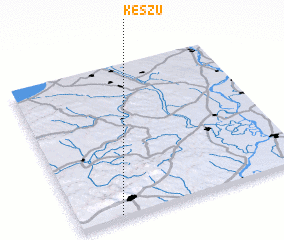 Places with similar names to Keszü, Hungary ::
Disclaimer :: Information on this page comes without warranty of any kind |
||
|
Where is Keszü? Elevation and coordinates ::
Latitude (lat): 46°1'0"N Longitude (lon): 18°11'0"E
Elevation (approx.): 159m (map arrows pan, magnifying glasses zoom) |
||
|
Visiting Keszü? Hotel/Accommodation ::
Book a hotel in Keszü Travel Guide ::
Buy a travel guide for Hungary rental cars ::
car rental offers GPS waypoint ::
download a GPX waypoint (PoI) of Keszü for your GPS receiver
|
||