|
search place name
|
||
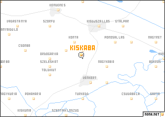
Kiskaba (Jász-Nagykun-Szolnok, Hungary)Kiskaba is a town in the Jász-Nagykun-Szolnok region of Hungary. An overview map of the region around Kiskaba is displayed below.
regional and 3d topo map of Kiskaba, Hungary ::
Kiskaba airports ::
The nearest airport is DEB - Debrecen, located 76.6 km north east of Kiskaba.
Other airports nearby include OMR - Oradea (89.9 km east), ARW - Arad (115.5 km south), BUD - Budapest Ferihegy (116.2 km west), TSR - Timisoara Traian Vuia (156.0 km south), Nearby towns ::
Igarió (1.9km north) //
Konta (3.9km north) //
Fehértó (3.1km north west) //
Túrkeve (5.7km south) //
Kismalomzug (5.7km south) //
Vénkert (5.7km south) //
Malomzugi-kert (5.7km south) //
Nagykaba (4.2km south east) //
Ördögárka (5.0km west) //
Szeleshát (5.4km west) //
Farkaszug (6.7km south east) //
Toldikút (6.3km south west) //
Porosállás (6.3km north east) //
Kisújszállás (7.8km north) //
Szőrfů (9.0km north west) //
[all distances 'as the bird flies' and approximate] 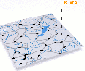 Places with similar names to Kiskaba, Hungary ::
// Cos Cob (US)
// Ga-Sekubu (ZA)
// Kouzoukobou (CF)
// Kosokobo I (TD)
// Kossokobo (TD)
// Kasegbe (CD)
// Kassikebo (ID)
// Qoz Gaba (SD)
// Kassagba (GN)
// Gasakba (NG)
Disclaimer :: Information on this page comes without warranty of any kind |
||
|
Where is Kiskaba? Elevation and coordinates ::
Latitude (lat): 47°9'0"N Longitude (lon): 20°44'0"E
Elevation (approx.): 81m (map arrows pan, magnifying glasses zoom) |
||
|
Visiting Kiskaba? Hotel/Accommodation ::
Book a hotel in Kiskaba Travel Guide ::
Buy a travel guide for Hungary rental cars ::
car rental offers GPS waypoint ::
download a GPX waypoint (PoI) of Kiskaba for your GPS receiver
|
||