|
search place name
|
||
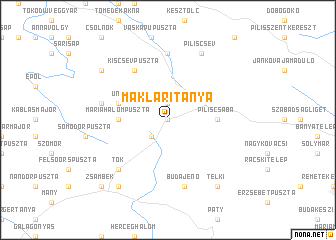
Makláritanya (Pest, Hungary)Makláritanya is a town in the Pest region of Hungary. An overview map of the region around Makláritanya is displayed below.
regional and 3d topo map of Makláritanya, Hungary ::
Makláritanya airports ::
The nearest airport is BUD - Budapest Ferihegy, located 40.8 km south east of Makláritanya.
Other airports nearby include SLD - Sliac (116.5 km north), BTS - Bratislava M R Stefanik (132.6 km north west), PZY - Piestany (132.8 km north west), TAT - Poprad Tatry (194.7 km north east), Nearby towns ::
Tinnye (0.0km north) //
Jászfalu (1.9km north) //
Perbál (2.2km south west) //
Máriahalompuszta (3.7km west) //
Piliscsaba (3.7km east) //
Úny (4.2km north west) //
Kiscsévpuszta (6.1km north west) //
Leányvár (7.4km north) //
Máriahalom (5.3km west) //
Budajenő (7.5km south) //
Tök (6.7km south west) //
Piliscsév (7.8km north) //
Binderpuszta (7.5km north west) //
Dág (7.5km north west) //
Vízimalom (8.3km south west) //
Telki (8.3km south east) //
Zsámbék (8.9km south west) //
[all distances 'as the bird flies' and approximate] 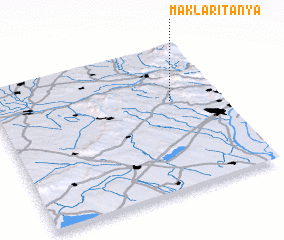 Places with similar names to Makláritanya, Hungary :: Disclaimer :: Information on this page comes without warranty of any kind |
||
|
Where is Makláritanya? Elevation and coordinates ::
Latitude (lat): 47°37'0"N Longitude (lon): 18°47'0"E
Elevation (approx.): 249m (map arrows pan, magnifying glasses zoom) |
||
|
Visiting Makláritanya? Hotel/Accommodation ::
Book a hotel in Makláritanya Travel Guide ::
Buy a travel guide for Hungary rental cars ::
car rental offers GPS waypoint ::
download a GPX waypoint (PoI) of Makláritanya for your GPS receiver
|
||