|
search place name
|
||
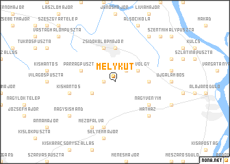
Mélykút (Fejér, Hungary)Mélykút is a town in the Fejér region of Hungary. An overview map of the region around Mélykút is displayed below.
regional and 3d topo map of Mélykút, Hungary ::
Mélykút airports ::
The nearest airport is BUD - Budapest Ferihegy, located 59.6 km north east of Mélykút.
Other airports nearby include OSI - Osijek (170.9 km south), BTS - Bratislava M R Stefanik (176.6 km north west), SLD - Sliac (183.8 km north), PZY - Piestany (194.8 km north), Nearby towns ::
Kisvenyimfelsőpuszta (1.3km west) //
Györgymajor (2.2km north east) //
Mélyvölgy (3.1km north east) //
Kisvenyimalsópuszta (3.1km south west) //
Perkáta (5.6km north) //
Bernátkút (3.8km east) //
Szentimretelep (5.7km north) //
Gecseg (5.7km north) //
Zsidókalapmajor (5.7km north) //
Cikola Úti Tanya (5.7km north) //
Máriatelep (5.7km north) //
Parragpuszta (4.2km north west) //
Nagyvenyim (5.3km south east) //
Határvölgy (5.3km south east) //
Banksismánd (7.5km south) //
Kishantos (5.4km west) //
Hatházsismánd (7.5km south) //
Hatház (6.7km south east) //
Mezőfalva (7.8km south) //
Nagysismánd (7.5km south west) //
Sáncpuszta (8.3km north east) //
Dajapuszta (9.0km north east) //
[all distances 'as the bird flies' and approximate] 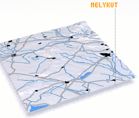 Places with similar names to Mélykút, Hungary ::
// Malaguit (PH)
// Malagutay (PH)
// Malacad (PH)
// Maloquiat (PH)
// Malcata (PT)
// Mélykút (HU)
// Muela Quieta (CU)
// Muela Quieta (CU)
// Mala Gata (BA)
// Malekutu (ZA)
Disclaimer :: Information on this page comes without warranty of any kind |
||
|
Where is Mélykút? Elevation and coordinates ::
Latitude (lat): 47°0'0"N Longitude (lon): 18°48'0"E
Elevation (approx.): 136m (map arrows pan, magnifying glasses zoom) |
||
|
Visiting Mélykút? Hotel/Accommodation ::
Book a hotel in Mélykút Travel Guide ::
Buy a travel guide for Hungary rental cars ::
car rental offers GPS waypoint ::
download a GPX waypoint (PoI) of Mélykút for your GPS receiver
|
||