|
search place name
|
||
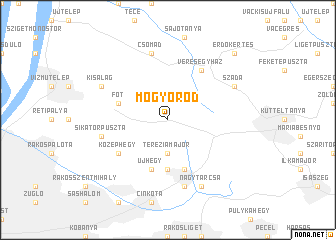
Mogyoród (Pest, Hungary)Mogyoród is a town in the Pest region of Hungary. An overview map of the region around Mogyoród is displayed below.
regional and 3d topo map of Mogyoród, Hungary ::
Mogyoród airports ::
The nearest airport is BUD - Budapest Ferihegy, located 18.1 km south of Mogyoród.
Other airports nearby include SLD - Sliac (115.7 km north), PZY - Piestany (155.6 km north west), TAT - Poprad Tatry (179.6 km north east), KSC - Kosice (189.6 km north east), Nearby towns ::
Teréziamajor (3.7km south) //
Nándormajor (5.6km south) //
Fót (4.2km north west) //
Bolgártelep (4.2km north west) //
Újhegy (5.7km south) //
Kerepesihatár (5.7km south) //
Szarvaspuszta (5.7km south) //
Hőstelep (5.7km south) //
Csömör (5.7km south) //
Veresegyház (6.1km north east) //
Kígyóstó (6.1km north east) //
Öreghegy Sor (6.1km north east) //
Középhegy (5.3km south west) //
Kerepestarcsa (7.5km south) //
Csomád (7.5km north) //
Sikátorpuszta (5.3km west) //
Szada (6.2km north east) //
Kisalag (6.2km north west) //
Halesztanya (6.2km north east) //
Nagytarcsa (7.8km south) //
Erdőkertes (8.9km north east) //
[all distances 'as the bird flies' and approximate] 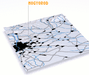 Places with similar names to Mogyoród, Hungary :: Disclaimer :: Information on this page comes without warranty of any kind |
||
|
Where is Mogyoród? Elevation and coordinates ::
Latitude (lat): 47°36'0"N Longitude (lon): 19°15'0"E
Elevation (approx.): 233m (map arrows pan, magnifying glasses zoom) |
||
|
Visiting Mogyoród? Hotel/Accommodation ::
Book a hotel in Mogyoród Travel Guide ::
Buy a travel guide for Hungary rental cars ::
car rental offers GPS waypoint ::
download a GPX waypoint (PoI) of Mogyoród for your GPS receiver
|
||