|
search place name
|
||
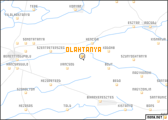
Oláhtanya (Hajdú-Bihar, Hungary)Oláhtanya is a town in the Hajdú-Bihar region of Hungary. An overview map of the region around Oláhtanya is displayed below.
regional and 3d topo map of Oláhtanya, Hungary ::
Oláhtanya airports ::
The nearest airport is OMR - Oradea, located 27.0 km south east of Oláhtanya.
Other airports nearby include DEB - Debrecen (30.7 km north), SUJ - Satu Mare (105.6 km north east), ARW - Arad (120.0 km south), BAY - Baia Mare Tautii Magheraus (143.4 km east), Nearby towns ::
Gáborján (2.2km north west) //
Váncsod (3.1km south west) //
Hencida (3.9km north) //
Berektanya (3.9km north) //
Ádámtanya (3.9km north) //
Kődomb (4.2km north east) //
Bojt (4.2km south east) //
Szentpéterszeg (5.4km west) //
Mezőpeterd (7.5km south west) //
Bedő (7.5km south east) //
[all distances 'as the bird flies' and approximate] 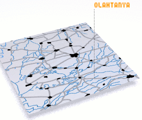 Places with similar names to Oláhtanya, Hungary ::
// Oláhtanya (HU)
Disclaimer :: Information on this page comes without warranty of any kind |
||
|
Where is Oláhtanya? Elevation and coordinates ::
Latitude (lat): 47°13'0"N Longitude (lon): 21°41'0"E
Elevation (approx.): 92m (map arrows pan, magnifying glasses zoom) |
||
|
Visiting Oláhtanya? Hotel/Accommodation ::
Book a hotel in Oláhtanya Travel Guide ::
Buy a travel guide for Hungary rental cars ::
car rental offers GPS waypoint ::
download a GPX waypoint (PoI) of Oláhtanya for your GPS receiver
|
||